MyTopo
Owatonna SE Minnesota US Topo Map
Couldn't load pickup availability
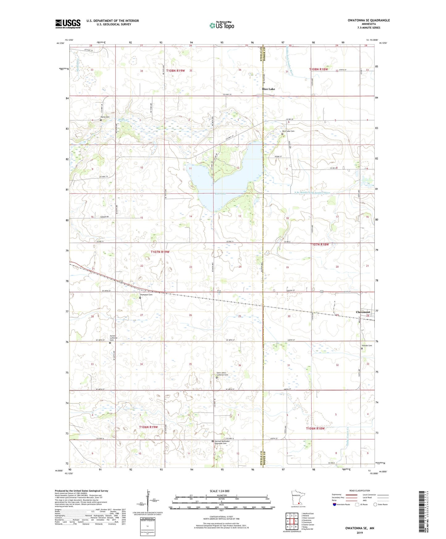
2022 topographic map quadrangle Owatonna SE in the state of Minnesota. Scale: 1:24000. Based on the newly updated USGS 7.5' US Topo map series, this map is in the following counties: Steele, Dodge. The map contains contour data, water features, and other items you are used to seeing on USGS maps, but also has updated roads and other features. This is the next generation of topographic maps. Printed on high-quality waterproof paper with UV fade-resistant inks.
Quads adjacent to this one:
West: Owatonna
Northwest: Medford East
North: Moland
Northeast: West Concord
East: Claremont
Southeast: Hayfield NW
South: Bixby
Southwest: Steele Center
This map covers the same area as the classic USGS quad with code o44093a1.
Contains the following named places: Aurora Church, Aurora Lutheran Cemetery, Dania Cemetery, Geology of the Rice Lake Area Historical Marker, German Methodist Episcopal Cemetery, Havana Hills Golf Course, Hillside Cemetery, Judicial Ditch Number Seven, Moonan Marsh, Moonan Marsh Dam, Peace Lutheran Church, Rice Lake, Rice Lake Cemetery, Rice Lake Church, Rice Lake Dam, Rice Lake State Park, Saint John's Lutheran Cemetery, Saint Johns School, School Number 2105, School Number 2106, School Number 2134, School Number 2136, School Number 2147, Thompson Cemetery, Township of Havana, ZIP Code: 55924