MyTopo
Montgomery Minnesota US Topo Map
Couldn't load pickup availability
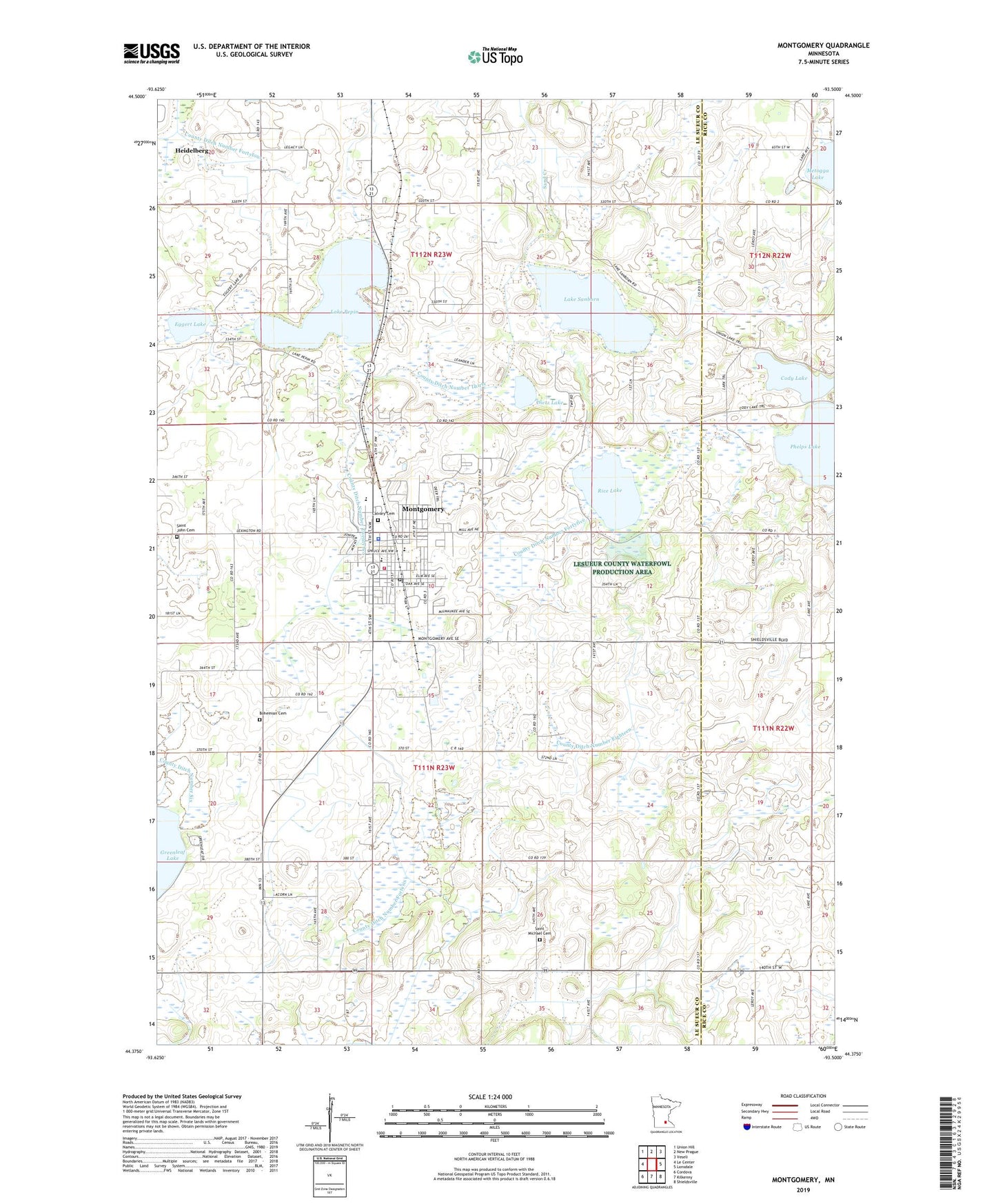
2019 topographic map quadrangle Montgomery in the state of Minnesota. Scale: 1:24000. Based on the newly updated USGS 7.5' US Topo map series, this map is in the following counties: Le Sueur, Rice. The map contains contour data, water features, and other items you are used to seeing on USGS maps, but also has updated roads and other features. This is the next generation of topographic maps. Printed on high-quality waterproof paper with UV fade-resistant inks.
Quads adjacent to this one:
West: Le Center
Northwest: Union Hill
North: New Prague
Northeast: Veseli
East: Lonsdale
Southeast: Shieldsville
South: Kilkenny
Southwest: Cordova
Contains the following named places: Arts and Heritage Center, Bohemian Cemetery, Calvary Cemetery, City of Montgomery, County Ditch Number Eighteen, County Ditch Number Forty, County Ditch Number Fortyfive, County Ditch Number Fortyfour, County Ditch Number Fortysix, County Ditch Number Sixtythree, County Ditch Number Thirty, County Ditch Number Twentytwo, Dietz Lake, Eggert Lake, Holy Redeemer Catholic Church, KCHK-FM (New Prague), Lake Pepin, Lake Sanborn, Memorial Park, Metogga Lake, Montgomery, Montgomery - Lonsdale Middle School, Montgomery - Lonsdale Secondary School, Montgomery Area Emergency Medical Services, Montgomery Elementary - Middle School, Montgomery Fire Department, Montgomery Golf Club, Montgomery Medical Clinic, Montgomery Orchards, Montgomery Police Department, Montgomery Post Office, Montgomery Public Library, Montgomery Wayside Park, Most Holy Redeemer Catholic School, Northside Park, Phelps Lake, Prince of Peace Community Church, Rice Lake, Saint John Cemetery, Saint John Lutheran Church, Saint Michael Cemetery, Township of Lanesburgh, Township of Montgomery, Tri - City United High School, ZIP Code: 56069