MyTopo
Morton SE Minnesota US Topo Map
Couldn't load pickup availability
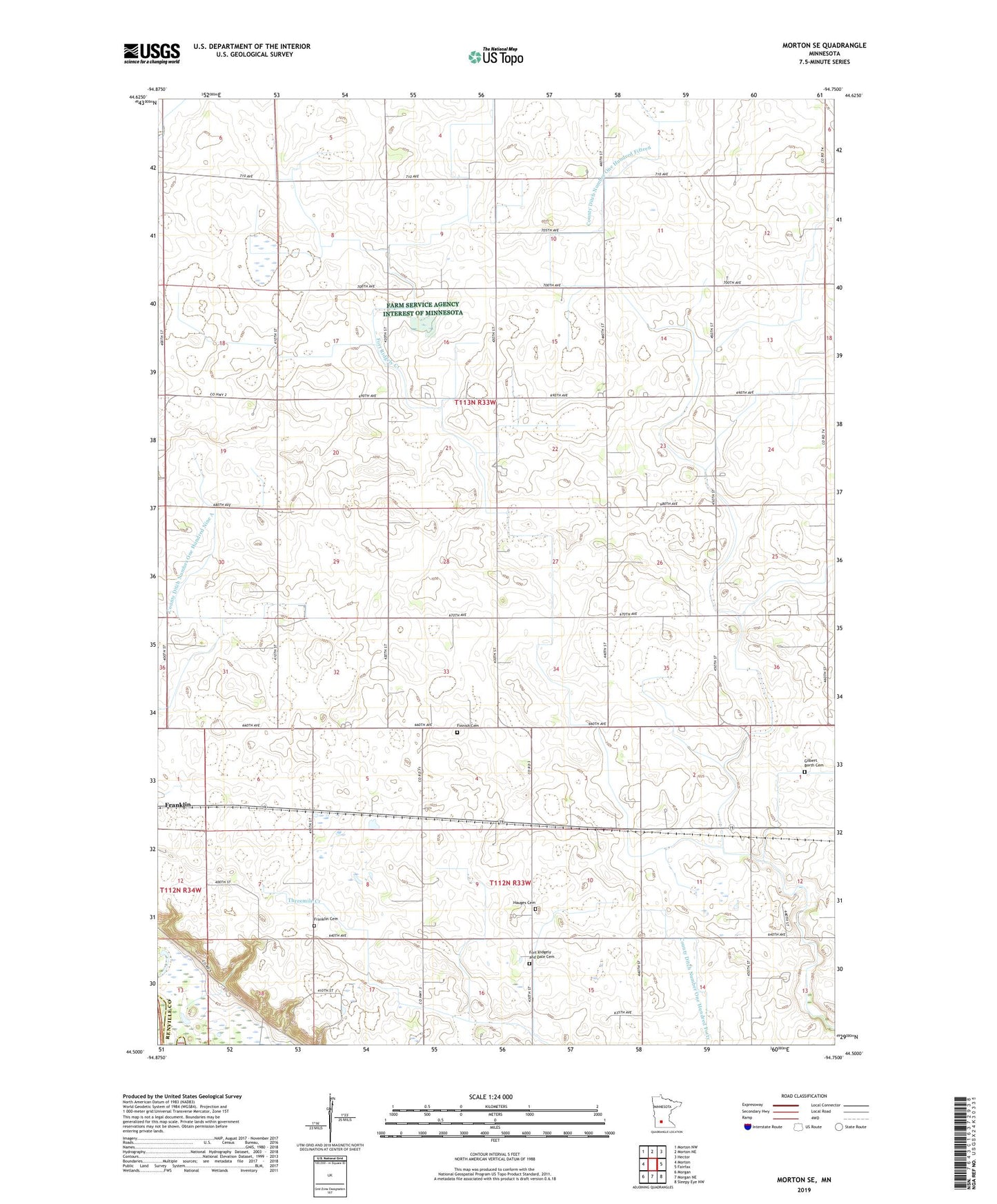
2022 topographic map quadrangle Morton SE in the state of Minnesota. Scale: 1:24000. Based on the newly updated USGS 7.5' US Topo map series, this map is in the following counties: Renville, Redwood. The map contains contour data, water features, and other items you are used to seeing on USGS maps, but also has updated roads and other features. This is the next generation of topographic maps. Printed on high-quality waterproof paper with UV fade-resistant inks.
Quads adjacent to this one:
West: Morton
Northwest: Morton NW
North: Morton NE
Northeast: Hector
East: Fairfax
Southeast: Sleepy Eye NW
South: Morgan NE
Southwest: Morgan
This map covers the same area as the classic USGS quad with code o44094e7.
Contains the following named places: Central Church, County Ditch Number One Hundred Fifteen, County Ditch Number One Hundred Forty, County Ditch Number One Hundred Nine A, County Ditch Number One Hundred Six A, Finnish Cemetery, Finnish Church, Fort Ridgely and Dale Cemetery, Fort Ridgely and Dale Church, Franklin Cemetery, Gilbert Borth Cemetery, Hauges Cemetery, Nosbush Dairy, School Number 1, School Number 10, Township of Bandon, Township of Camp, Zion Lutheran Church, ZIP Code: 55333