MyTopo
Morgan NE Minnesota US Topo Map
Couldn't load pickup availability
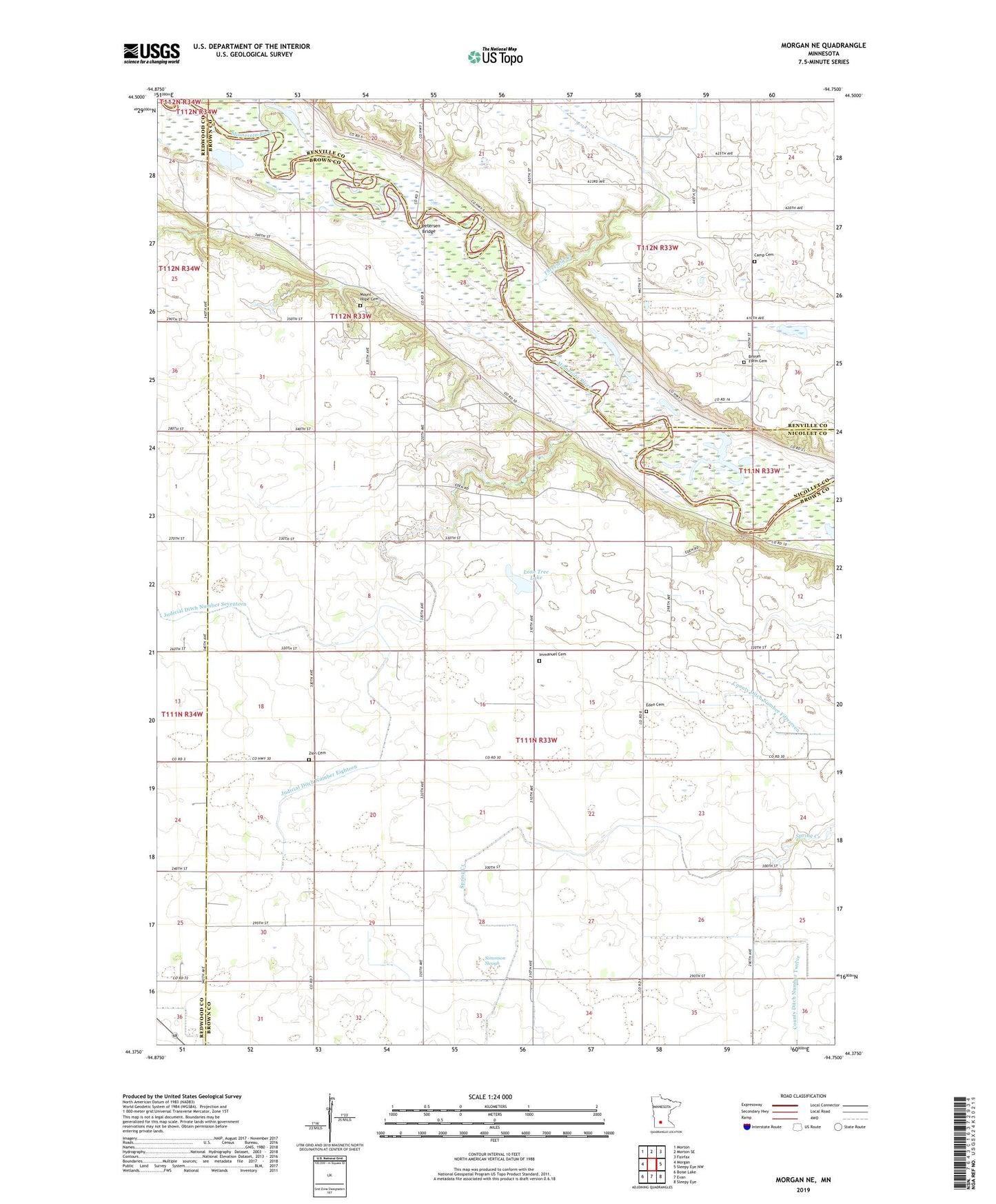
2022 topographic map quadrangle Morgan NE in the state of Minnesota. Scale: 1:24000. Based on the newly updated USGS 7.5' US Topo map series, this map is in the following counties: Brown, Renville, Redwood, Nicollet. The map contains contour data, water features, and other items you are used to seeing on USGS maps, but also has updated roads and other features. This is the next generation of topographic maps. Printed on high-quality waterproof paper with UV fade-resistant inks.
Quads adjacent to this one:
West: Morgan
Northwest: Morton
North: Morton SE
Northeast: Fairfax
East: Sleepy Eye NW
Southeast: Sleepy Eye
South: Evan
Southwest: Boise Lake
This map covers the same area as the classic USGS quad with code o44094d7.
Contains the following named places: Boyum Farm Cemetery, Camp Cemetery, Camp Church, County Ditch Number Fiftyseven, County Ditch Number Twelve, County Park Number Four, Eden Cemetery, Immanuel Cemetery, Immanuel Church, Judicial Ditch Number Eighteen, Judicial Ditch Number Seventeen, Kettners Landing, Lone Tree Lake, Mount Hope Cemetery, Petersen Bridge, School Number 16, School Number 31, School Number 34, School Number 35, School Number 57, School Number 74, Simonson Slough, Threemile Creek, Township of Eden, Zion Cemetery