MyTopo
Myrtle Minnesota US Topo Map
Couldn't load pickup availability
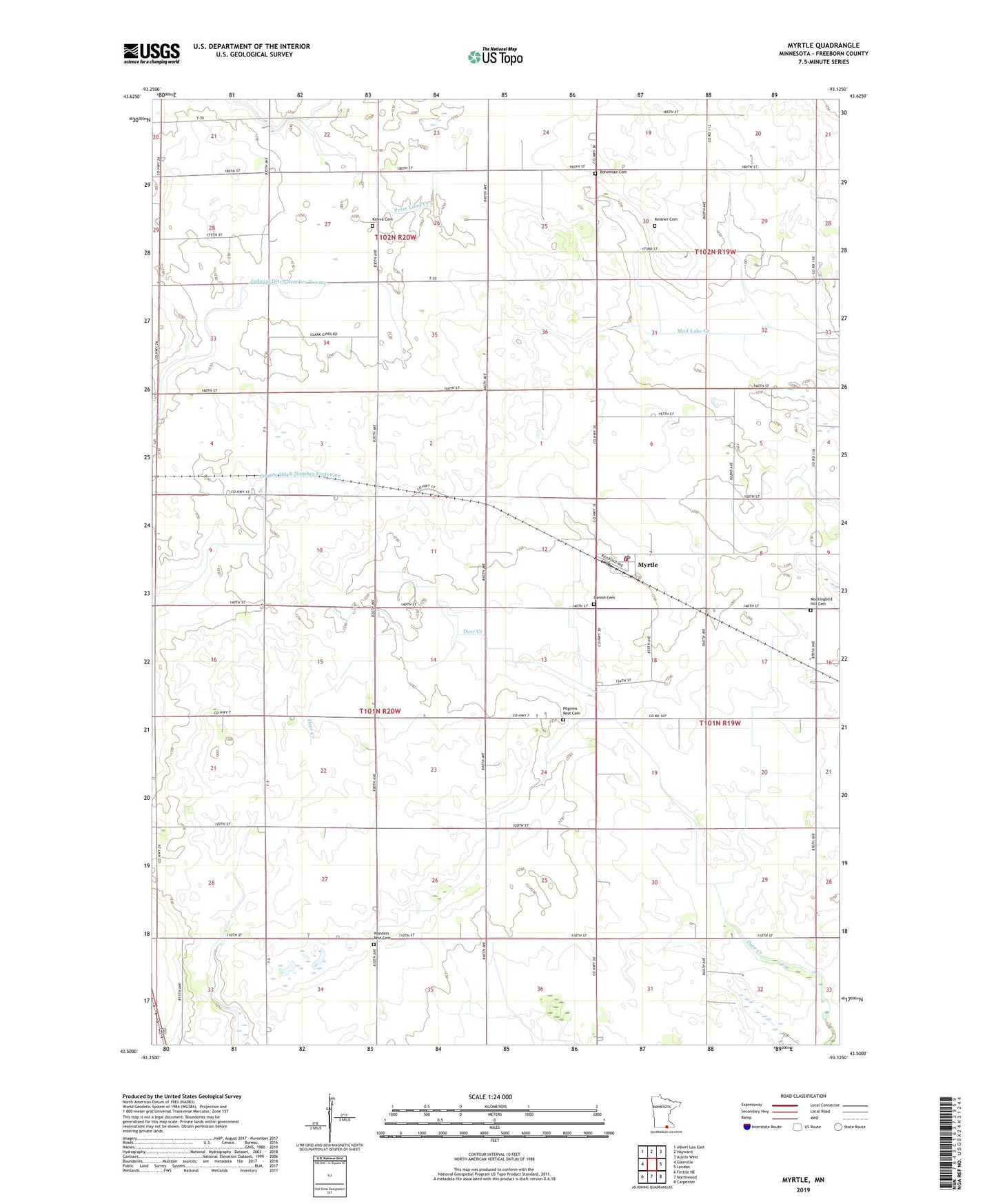
2019 topographic map quadrangle Myrtle in the state of Minnesota. Scale: 1:24000. Based on the newly updated USGS 7.5' US Topo map series, this map is in the following counties: Freeborn. The map contains contour data, water features, and other items you are used to seeing on USGS maps, but also has updated roads and other features. This is the next generation of topographic maps. Printed on high-quality waterproof paper with UV fade-resistant inks.
Quads adjacent to this one:
West: Glenville
Northwest: Albert Lea East
North: Hayward
Northeast: Austin West
East: London
Southeast: Carpenter
South: Northwood
Southwest: Fertile NE
Contains the following named places: Barron School, Benesh School, Bethlehem Church, Bohemian Cemetery, City of Myrtle, Corner School, County Ditch Number Fortynine, County Ditch Number Seventyone, Danish Cemetery, Davis School, Funfar School, Judicial Ditch Number Twenty, Kestner Cemetery, Kirk School, KQPR-FM (Albert Lea), Krikva Cemetery, Lao School, Mockingbird Hill Cemetery, Myrtle, Myrtle Fire Department, Myrtle Museum, Myrtle Post Office, Nelson School, Pilgrims Rest Cemetery, Schilling School, Township of Shell Rock, Wanders Rest Cemetery, Will School, ZIP Code: 56036