MyTopo
Hayward Minnesota US Topo Map
Couldn't load pickup availability
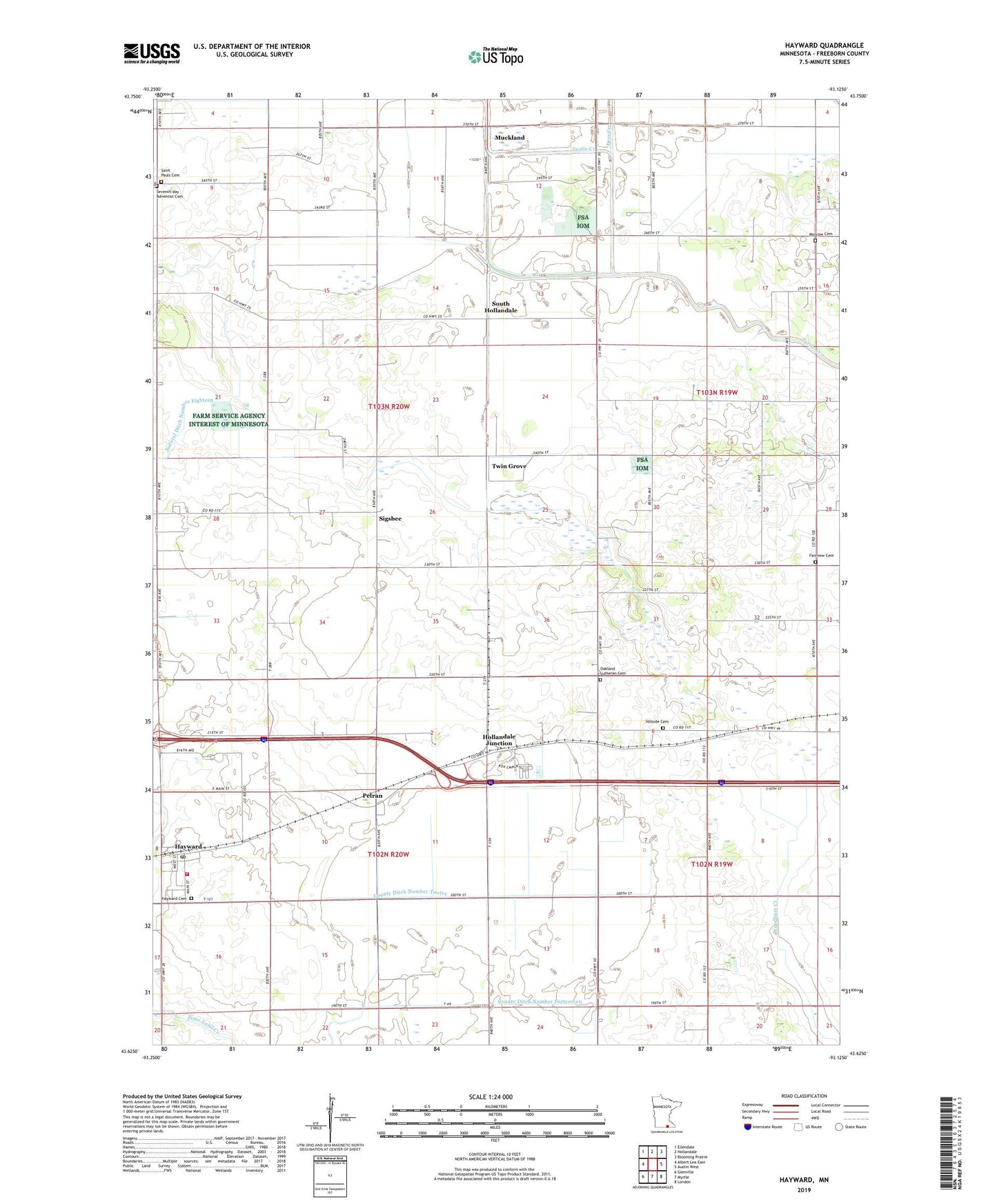
2022 topographic map quadrangle Hayward in the state of Minnesota. Scale: 1:24000. Based on the newly updated USGS 7.5' US Topo map series, this map is in the following counties: Freeborn. The map contains contour data, water features, and other items you are used to seeing on USGS maps, but also has updated roads and other features. This is the next generation of topographic maps. Printed on high-quality waterproof paper with UV fade-resistant inks.
Quads adjacent to this one:
West: Albert Lea East
Northwest: Ellendale
North: Hollandale
Northeast: Blooming Prairie
East: Austin West
Southeast: London
South: Myrtle
Southwest: Glenville
This map covers the same area as the classic USGS quad with code o43093f2.
Contains the following named places: Albert Lea - Austin Kampground, Bell School, Campbell School, City of Hayward, County Ditch Number Fortyseven, County Ditch Number Twelve, Crook School, Deer Creek, Deveraux School, Fairview Cemetery, Hayward, Hayward Cemetery, Hayward Fire Department, Hayward Lutheran Church, Hayward Post Office, Hillside Cemetery, Holiday Park Gold Course, Hollandale Junction, Judicial Ditch Number Eighteen, KAAL-TV (Austin), KAUS-FM (Austin), Lee School, Lyle School, Moscow Cemetery, Moscow Church, Muckland, Oakland Church, Oakland Lutheran Cemetery, Petran, Saint Pauls Cemetery, Seventh-day Adventist Cemetery, Sigsbee, Sigsbee Post Office, South Hollandale, Stoa School, Sumner School, Township of Hayward, Township of Riceland, Twin Grove, ZIP Code: 56043