MyTopo
Fertile NE Iowa US Topo Map
Couldn't load pickup availability
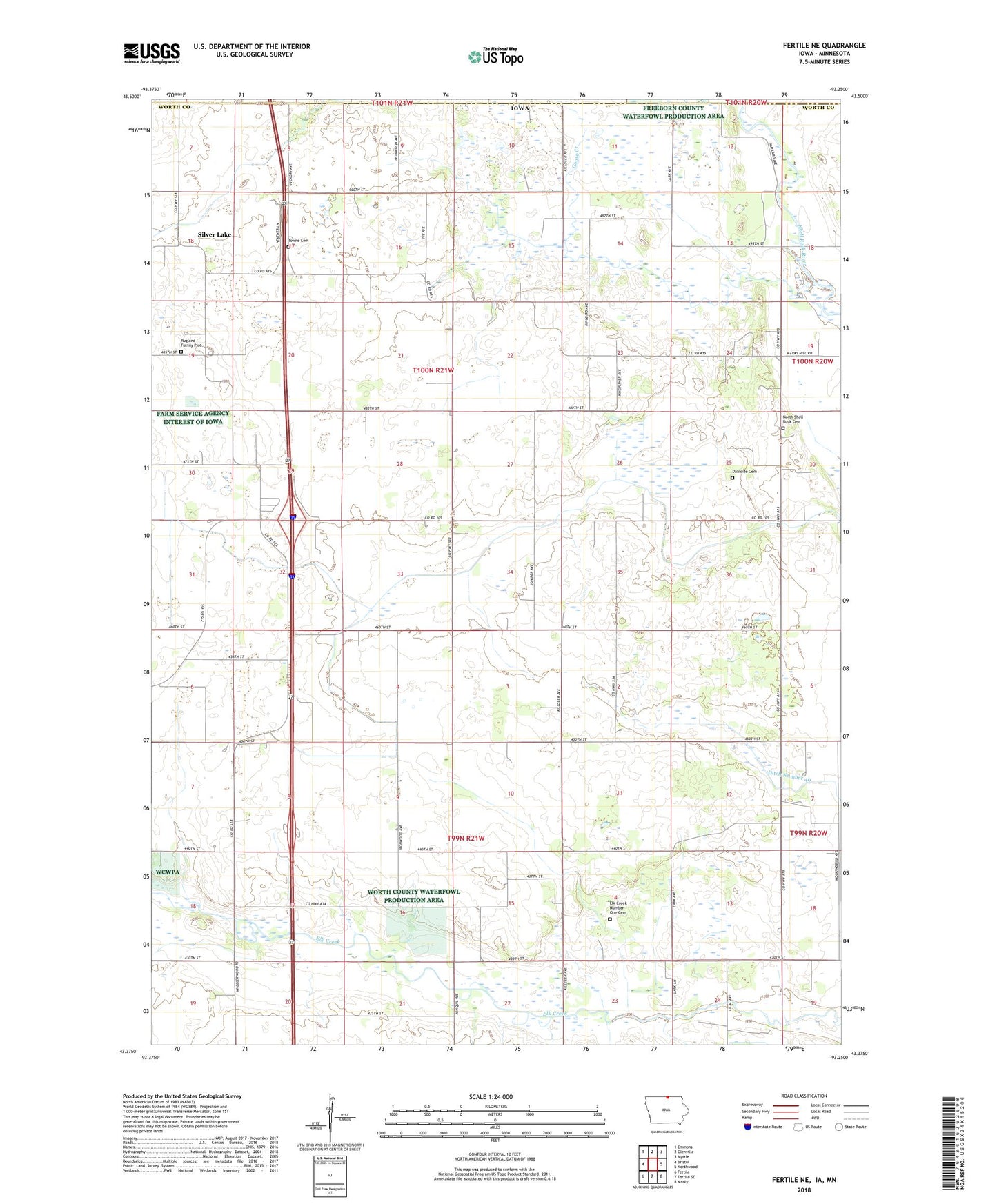
2022 topographic map quadrangle Fertile NE in the state of Iowa. Scale: 1:24000. Based on the newly updated USGS 7.5' US Topo map series, this map is in the following counties: Worth, Freeborn. The map contains contour data, water features, and other items you are used to seeing on USGS maps, but also has updated roads and other features. This is the next generation of topographic maps. Printed on high-quality waterproof paper with UV fade-resistant inks.
Quads adjacent to this one:
West: Bristol
Northwest: Emmons
North: Glenville
Northeast: Myrtle
East: Northwood
Southeast: Manly
South: Fertile SE
Southwest: Fertile
Contains the following named places: Christianson-Taylor Wildlife Area, Dahlside Cemetery, Ditch Number 2, Elk Creek Number One Cemetery, Elkcreek Post Office, Hanson Area, Hartland Forest, Hartland Post Office, Holt Farms Airport, Myre Timber, North Shell Rock Cemetery, Ochee Yahola County Park, Panicum Prairie, Rugland Family Plot, Sawin Wildlife Area, Silver Lake, Stimes Forest County Park, Tenold, Tenold Post Office, Towne Cemetery, Township of Brookfield, Township of Hartland, Turvoid Woods County Park, Worth County, ZIP Code: 50459