MyTopo
New Market Minnesota US Topo Map
Couldn't load pickup availability
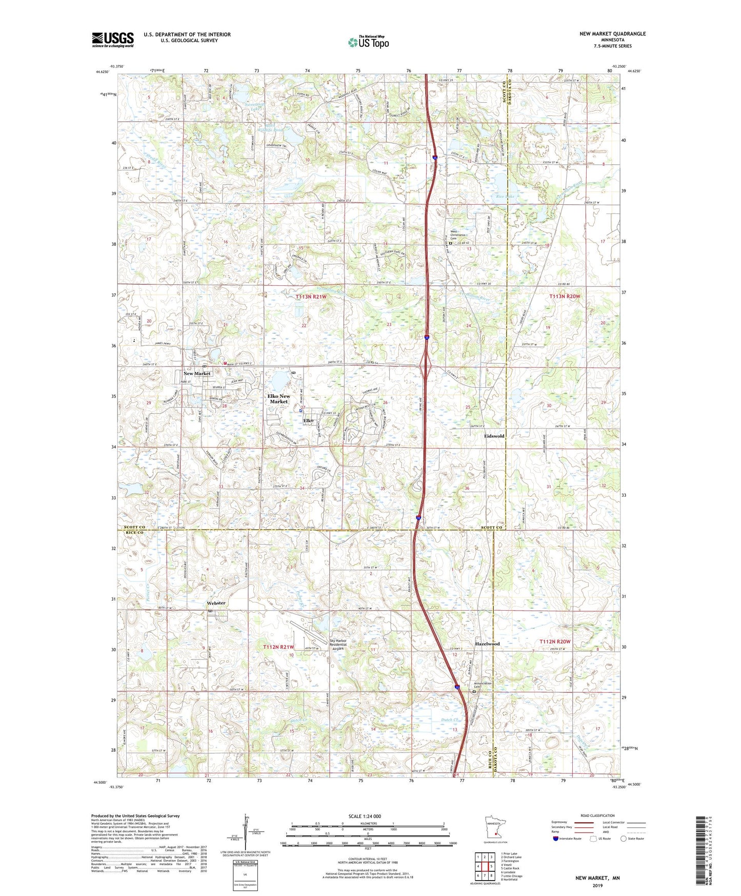
2019 topographic map quadrangle New Market in the state of Minnesota. Scale: 1:24000. Based on the newly updated USGS 7.5' US Topo map series, this map is in the following counties: Scott, Rice, Dakota. The map contains contour data, water features, and other items you are used to seeing on USGS maps, but also has updated roads and other features. This is the next generation of topographic maps. Printed on high-quality waterproof paper with UV fade-resistant inks.
Quads adjacent to this one:
West: Veseli
Northwest: Prior Lake
North: Orchard Lake
Northeast: Farmington
East: Castle Rock
Southeast: Northfield
South: Little Chicago
Southwest: Lonsdale
Contains the following named places: Annunciation Cemetery, Big Woods Historical Marker, Church of the Annunciation, City of Elko, City of Elko New Market, City of New Market, Eagle View Elementary School, Eidswold, Eidswold Post Office, Elko, Elko New Market, Elko New Market Fire Department, Elko New Market Police Department, Elko New Market Post Office, Hazelwood, Minnesota National Speedway, Nelson's Apple Farm, New Market, New Market City Hall, New Market Post Office, New Market Public Library, New Market South Bend Rest Area, Pettit Wildlife Pond, Pettit Wildlife Pond Dam, Rice Lake, Saint Nicholas Church, Sky Harbor Residential Airpark, Solor Church, Solor Lutheran Cemetery, Steve Maza Pond Dam, Sweetbrier Lake, Township of New Market, Township of Webster, Webster, Webster Post Office, West Christiania Cemetery, ZIP Codes: 55020, 55054