MyTopo
Nimrod SW Minnesota US Topo Map
Couldn't load pickup availability
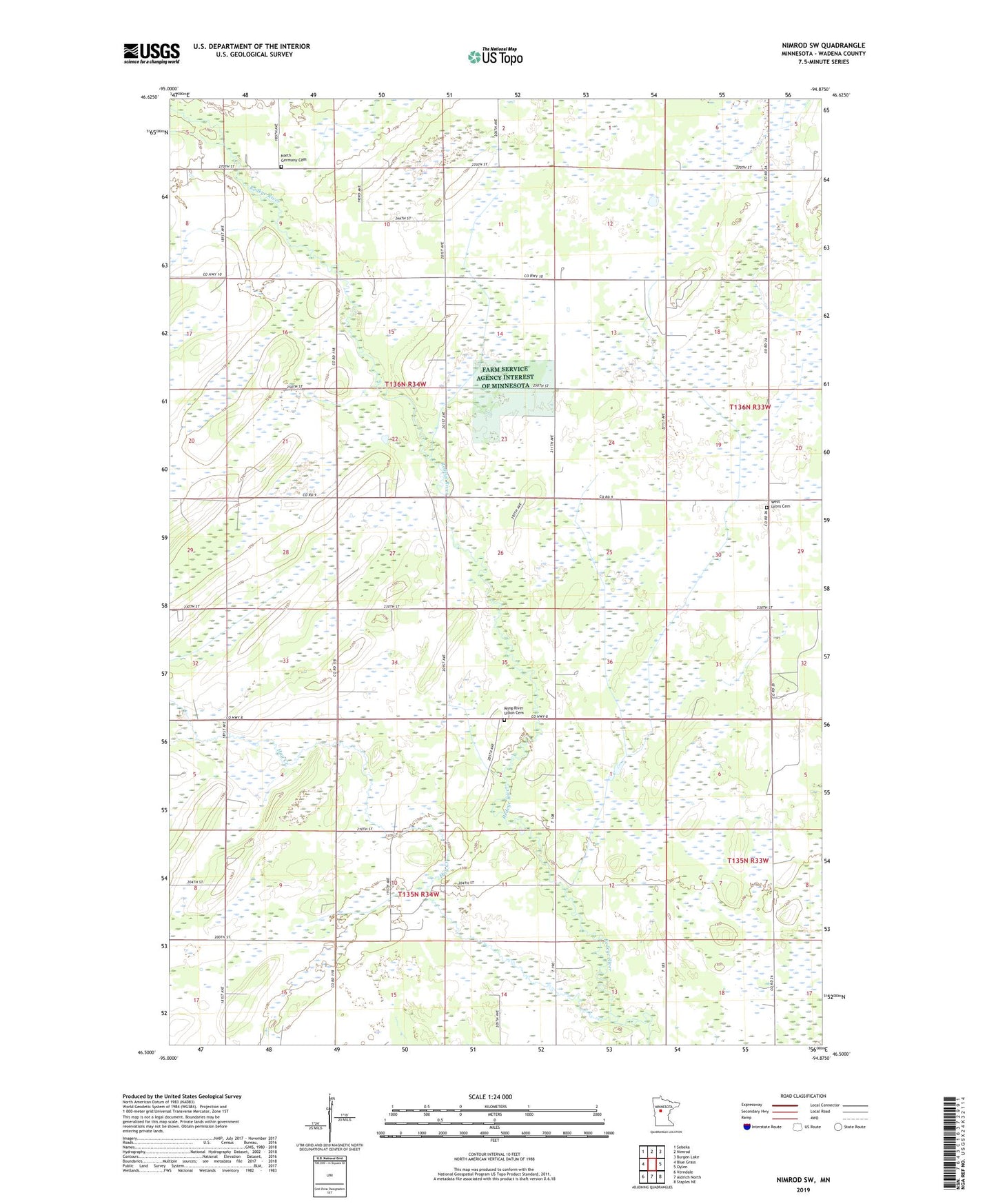
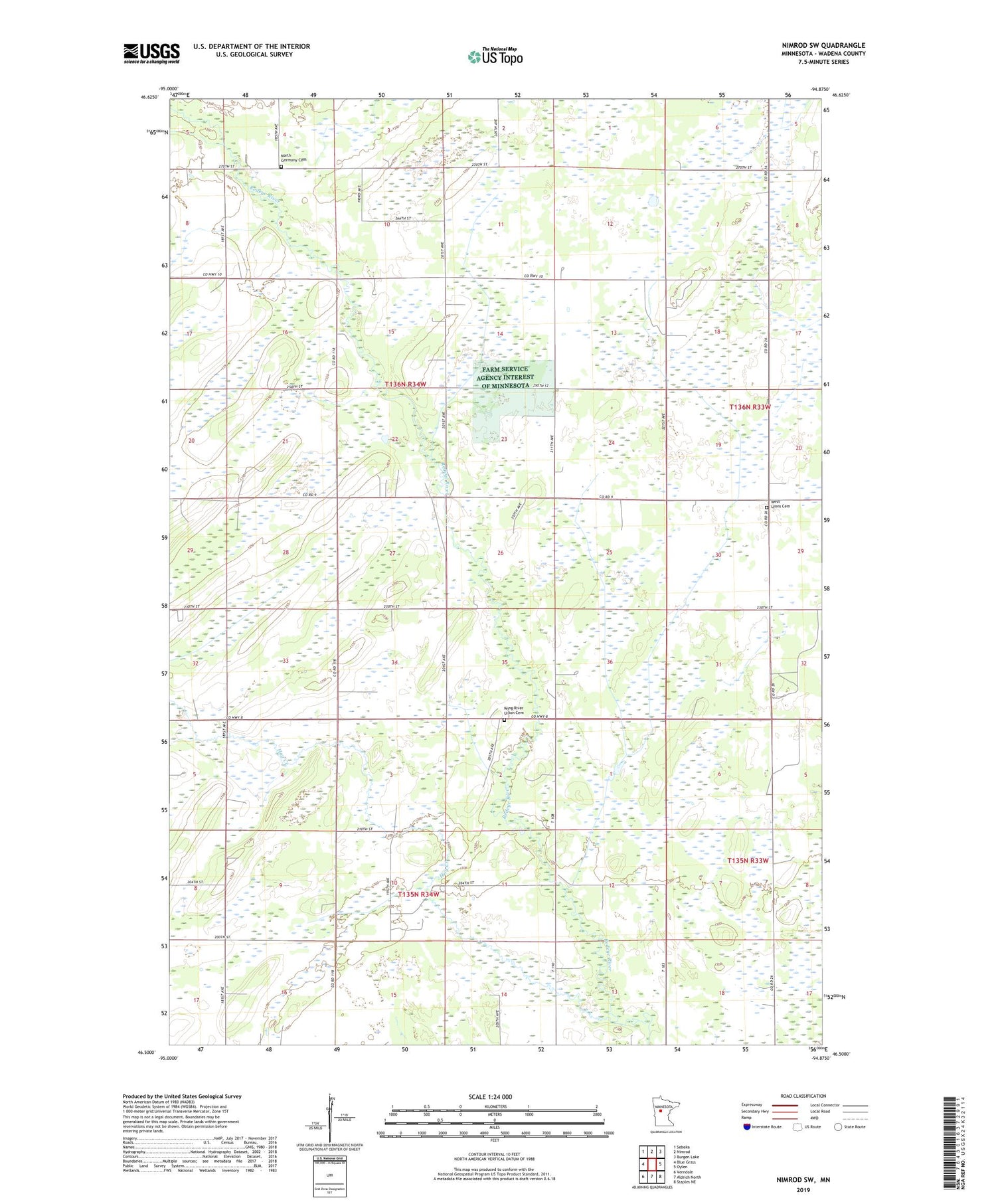
2019 topographic map quadrangle Nimrod SW in the state of Minnesota. Scale: 1:24000. Based on the newly updated USGS 7.5' US Topo map series, this map is in the following counties: Wadena. The map contains contour data, water features, and other items you are used to seeing on USGS maps, but also has updated roads and other features. This is the next generation of topographic maps. Printed on high-quality waterproof paper with UV fade-resistant inks.
Quads adjacent to this one:
West: Blue Grass
Northwest: Sebeka
North: Nimrod
Northeast: Burgen Lake
East: Oylen
Southeast: Staples NE
South: Aldrich North
Southwest: Verndale
Contains the following named places: Hay Creek, KKWS-FM (Wadena), North Germany Cemetery, School Number 2422, Township of North Germany, Wadena County, West Lyons Cemetery, Wing River Union Cemetery