MyTopo
Oylen Minnesota US Topo Map
Couldn't load pickup availability
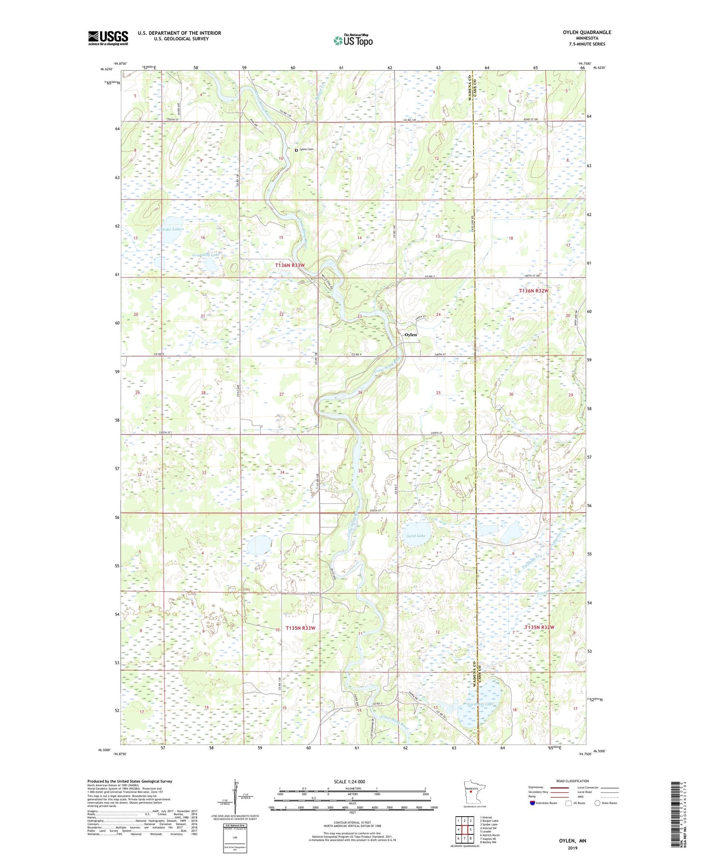
2022 topographic map quadrangle Oylen in the state of Minnesota. Scale: 1:24000. Based on the newly updated USGS 7.5' US Topo map series, this map is in the following counties: Wadena, Cass. The map contains contour data, water features, and other items you are used to seeing on USGS maps, but also has updated roads and other features. This is the next generation of topographic maps. Printed on high-quality waterproof paper with UV fade-resistant inks.
Quads adjacent to this one:
West: Nimrod SW
Northwest: Nimrod
North: Burgen Lake
Northeast: Spider Lake
East: Leader
Southeast: Motley NW
South: Staples NE
Southwest: Aldrich North
This map covers the same area as the classic USGS quad with code o46094e7.
Contains the following named places: Beaver Creek, Cottingham Park, Dry Sand Lake State Wildlife Management Area, Farnham Creek, Farnham Lake, Granning Lake, Knob Hill Campground, Little Round Hill Campground, Little Swamp Creek, Lyons Cemetery, Lyons State Forest, Martin Creek, Nanik Marl Pit, Oylen, Sand Lake, Strike Lake, Strike Lake State Wildlife Management Area, Tower Creek, Township of Bullard, Township of Lyons