MyTopo
Ogilvie Minnesota US Topo Map
Couldn't load pickup availability
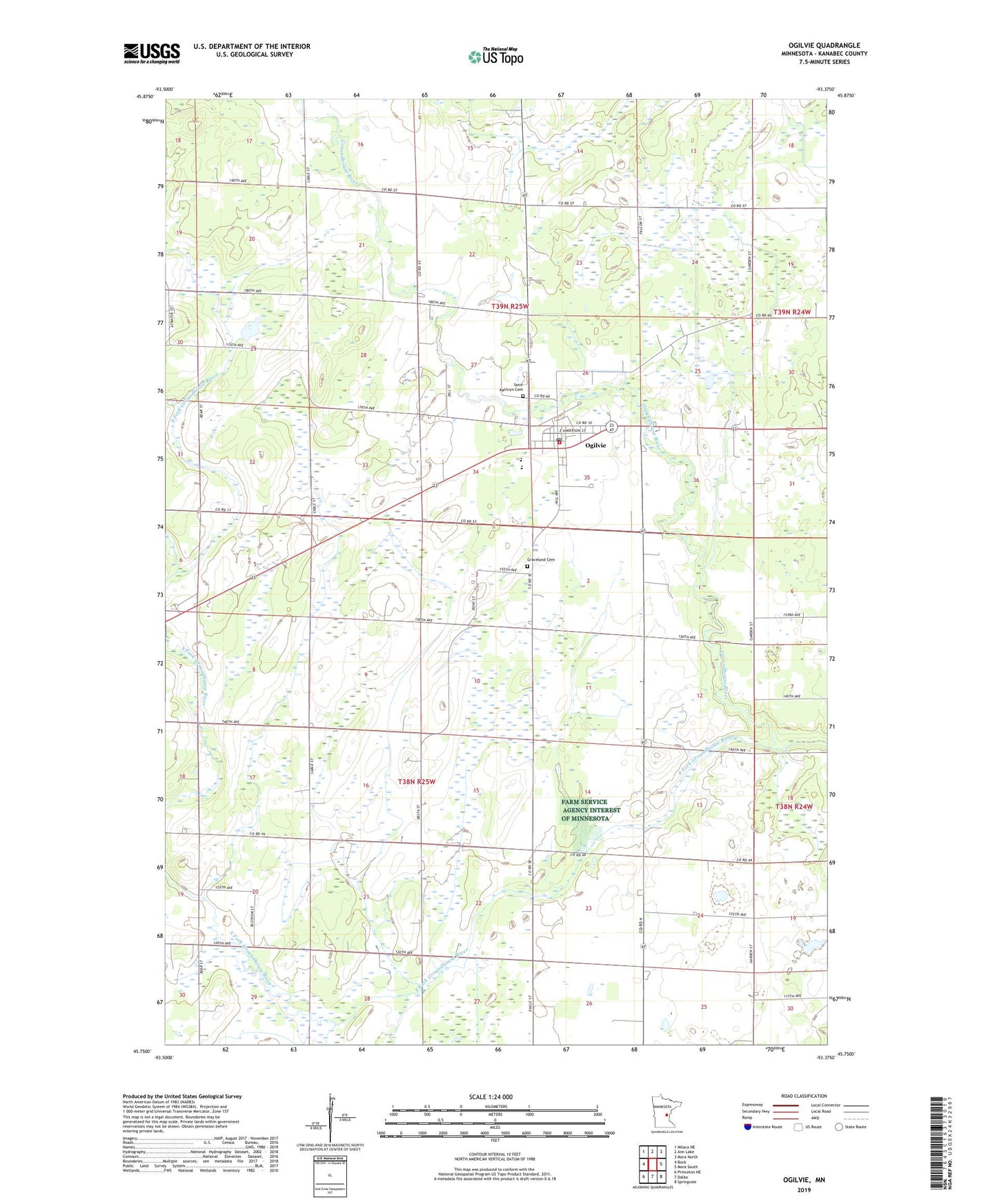
2019 topographic map quadrangle Ogilvie in the state of Minnesota. Scale: 1:24000. Based on the newly updated USGS 7.5' US Topo map series, this map is in the following counties: Kanabec. The map contains contour data, water features, and other items you are used to seeing on USGS maps, but also has updated roads and other features. This is the next generation of topographic maps. Printed on high-quality waterproof paper with UV fade-resistant inks.
Quads adjacent to this one:
West: Bock
Northwest: Milaca NE
North: Ann Lake
Northeast: Mora North
East: Mora South
Southeast: Springvale
South: Dalbo
Southwest: Princeton NE
Contains the following named places: City of Ogilvie, Graceland Cemetery, Ogilvie, Ogilvie Post Office, Ogilvie Volunteer Fire Department, Saint Kathryn Cemetery, South Fork Groundhouse River, Township of Kanabec, Township of South Fork, ZIP Code: 56358