MyTopo
Milaca NE Minnesota US Topo Map
Couldn't load pickup availability
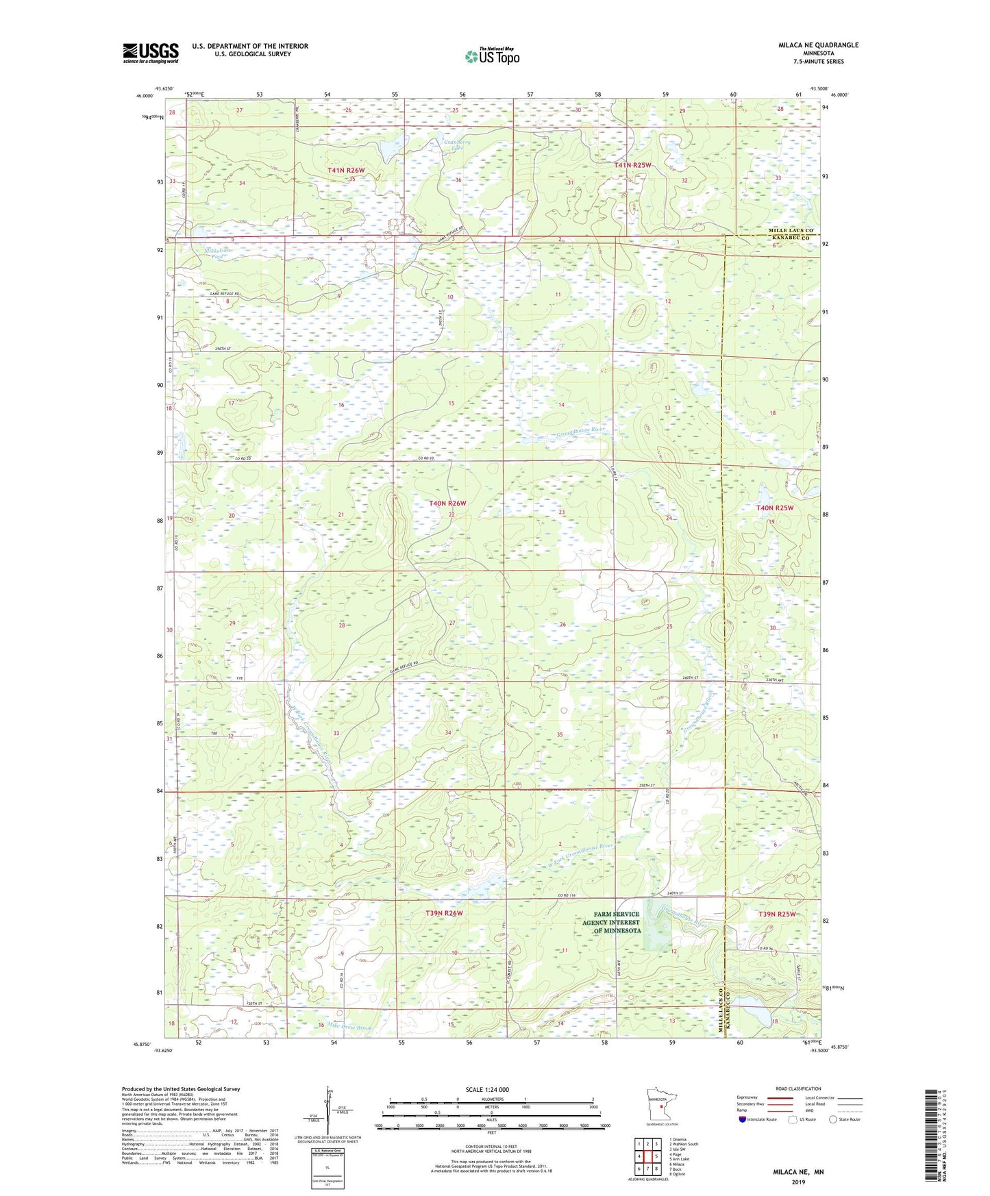
2022 topographic map quadrangle Milaca NE in the state of Minnesota. Scale: 1:24000. Based on the newly updated USGS 7.5' US Topo map series, this map is in the following counties: Mille Lacs, Kanabec. The map contains contour data, water features, and other items you are used to seeing on USGS maps, but also has updated roads and other features. This is the next generation of topographic maps. Printed on high-quality waterproof paper with UV fade-resistant inks.
Quads adjacent to this one:
West: Page
Northwest: Onamia
North: Wahkon South
Northeast: Isle SW
East: Ann Lake
Southeast: Ogilvie
South: Bock
Southwest: Milaca
This map covers the same area as the classic USGS quad with code o45093h5.
Contains the following named places: Cranberry Lake, Mikkelson Pool, Mille Lacs Lookout Tower, Mille Lacs State Wildlife Management Area, North Fork School, Rum River State Forest, Township of Mudgett, West Fork Groundhouse River, William Mills Pond Dam