MyTopo
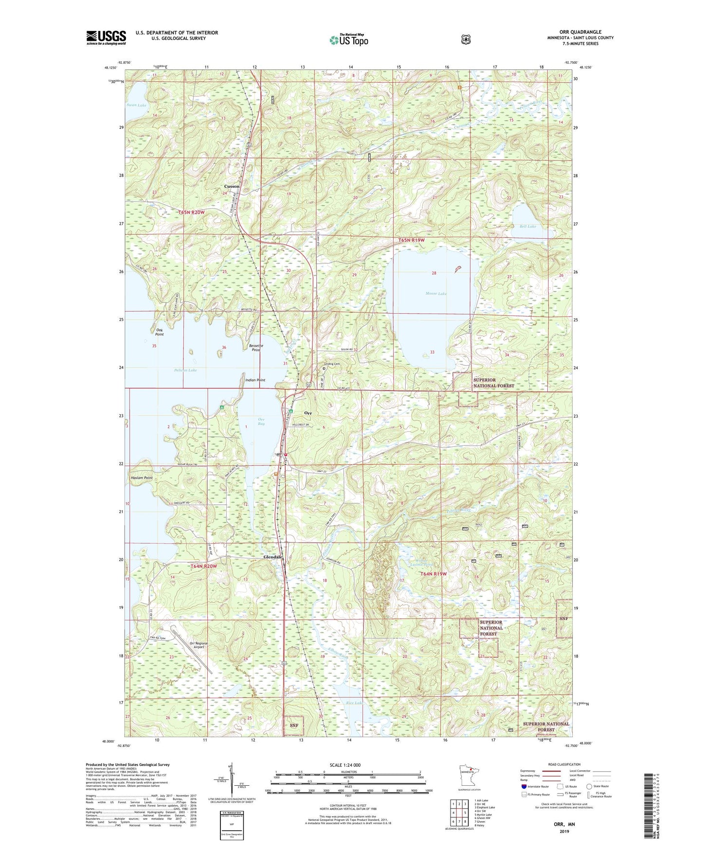
Orr Minnesota US Topo Map
Couldn't load pickup availability
Also explore the Orr Forest Service Topo of this same quad for updated USFS data
2022 topographic map quadrangle Orr in the state of Minnesota. Scale: 1:24000. Based on the newly updated USGS 7.5' US Topo map series, this map is in the following counties: St. Louis. The map contains contour data, water features, and other items you are used to seeing on USGS maps, but also has updated roads and other features. This is the next generation of topographic maps. Printed on high-quality waterproof paper with UV fade-resistant inks.
Quads adjacent to this one:
West: Orr SW
Northwest: Ash Lake
North: Orr NE
Northeast: Elephant Lake
East: Myrtle Lake
Southeast: Haley
South: Gheen
Southwest: Gheen NW
This map covers the same area as the classic USGS quad with code o48092a7.
Contains the following named places: Bell Lake, Bessette Point, Calvary Lutheran Church, Chippewa Campground, City of Orr, Cusson, Cusson Creek, Cusson Post Office, Cusson Station, Elbow River, Glendale, Haslam Point, Holy Cross Church, Indian Point, Indian Point Segment, Lakeview Baptist Church, Leiding Cemetery, Mobile United Methodist Church, Moose Lake, Oak Point, Orr, Orr Ambulance Service, Orr Bay, Orr Campground, Orr Post Office, Orr Regional Airport, Orr Roadside Parking Area, Orr Volunteer Fire Department, Pelican Lake Campground, Pelican Lake Dam, Pelican Lake Seaplane Base, Pine Acres Resort and Campground, Rice Lake, Sucker Creek, Sugarbush Segment, Swan Lake, Township of Leiding, Wilbur Luoma Pond, Wilbur Luoma Pond Dam