MyTopo
Orr SW Minnesota US Topo Map
Couldn't load pickup availability
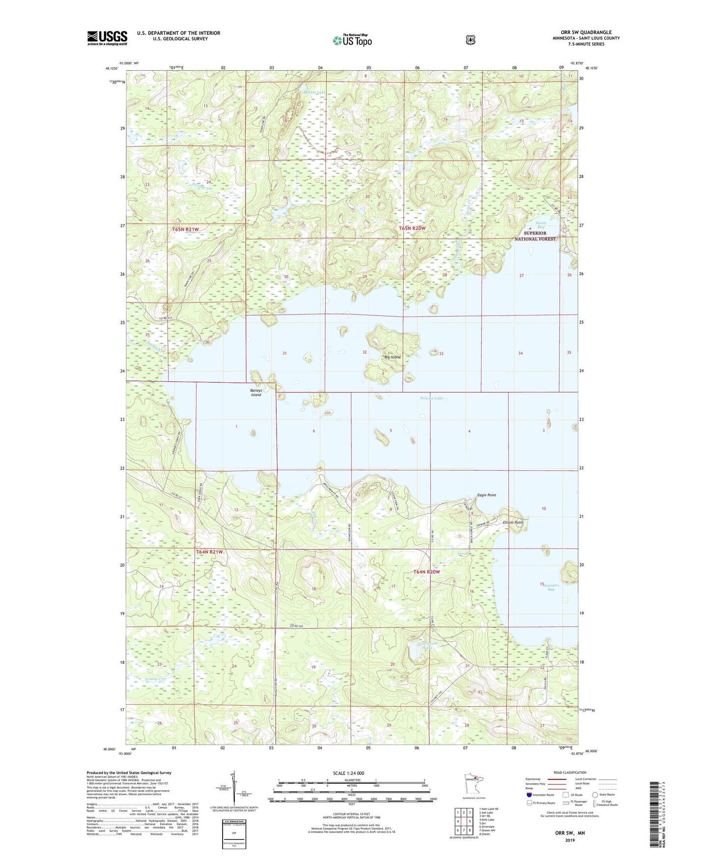
2022 topographic map quadrangle Orr SW in the state of Minnesota. Scale: 1:24000. Based on the newly updated USGS 7.5' US Topo map series, this map is in the following counties: St. Louis. The map contains contour data, water features, and other items you are used to seeing on USGS maps, but also has updated roads and other features. This is the next generation of topographic maps. Printed on high-quality waterproof paper with UV fade-resistant inks.
Quads adjacent to this one:
West: Nett Lake
Northwest: Nett Lake NE
North: Ash Lake
Northeast: Orr NE
East: Orr
Southeast: Gheen
South: Gheen NW
Southwest: Silverdale
This map covers the same area as the classic USGS quad with code o48092a8.
Contains the following named places: Aspen Resort and Campground, Backus Island, Baileys Island, Big Island, Cabin O'Pines Resort and Campground, Eagle Point, Elliott Point, Elm Creek, Franey Creek, Gabrielson Lake, Pelican Lake, Rabbit Lake, Saunders Bay, Susan Bay, Swan Creek