
MyTopo
Park Rapids SW Minnesota US Topo Map
Couldn't load pickup availability
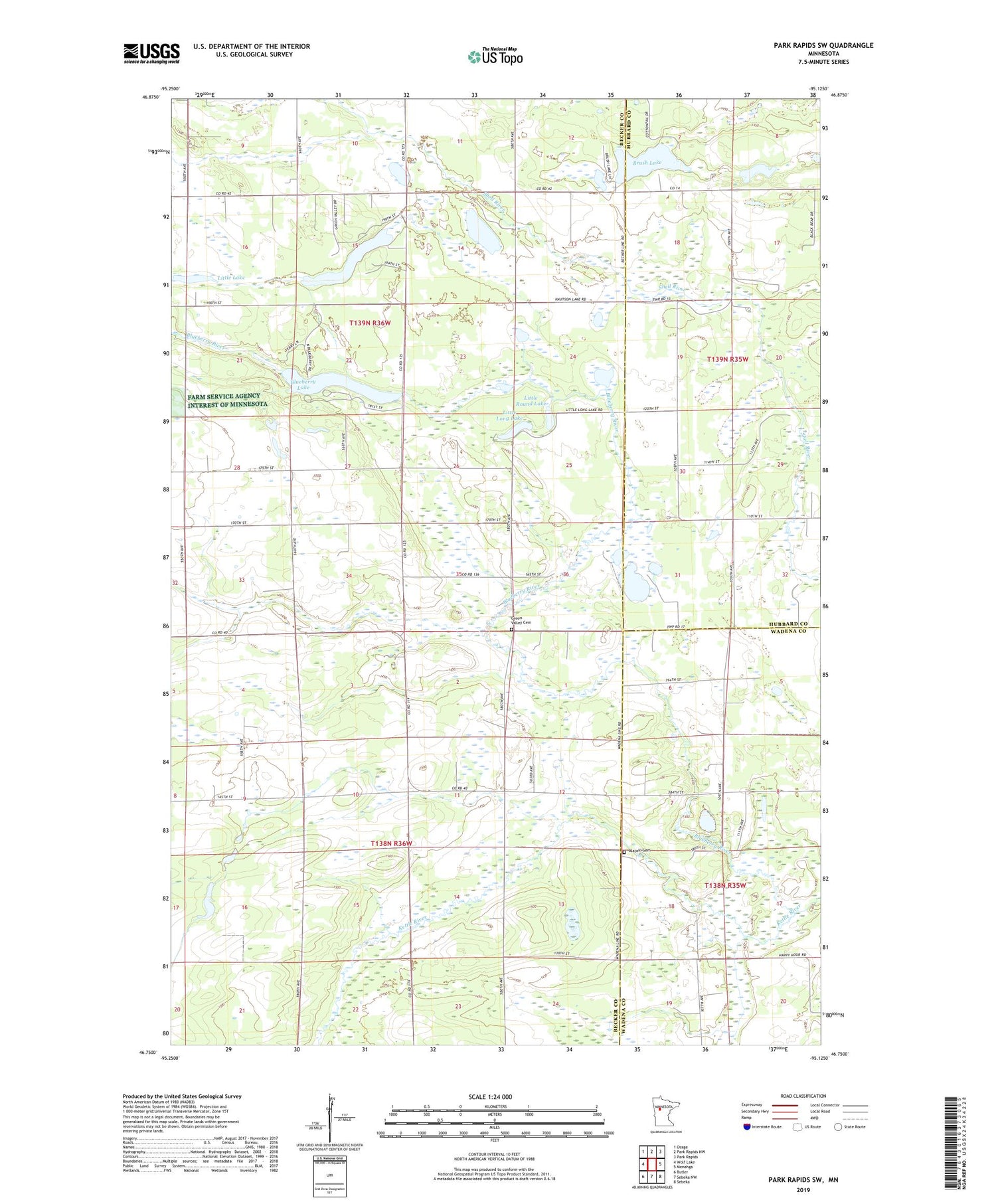
2019 topographic map quadrangle Park Rapids SW in the state of Minnesota. Scale: 1:24000. Based on the newly updated USGS 7.5' US Topo map series, this map is in the following counties: Becker, Hubbard, Wadena. The map contains contour data, water features, and other items you are used to seeing on USGS maps, but also has updated roads and other features. This is the next generation of topographic maps. Printed on high-quality waterproof paper with UV fade-resistant inks.
Quads adjacent to this one:
West: Wolf Lake
Northwest: Osage
North: Park Rapids NW
Northeast: Park Rapids
East: Menahga
Southeast: Sebeka
South: Sebeka NW
Southwest: Butler
Contains the following named places: Alajoki Cemetery, Blueberry Lake, Brush Lake, Green Valley Cemetery, Kettle River, Knutson Lake, Little Lake, Little Long Lake, Little Round Lake, Lowe State Wildlife Management Area, Shipman Lake, Township of Green Valley, Township of Runeberg


