MyTopo
Perley Minnesota US Topo Map
Couldn't load pickup availability
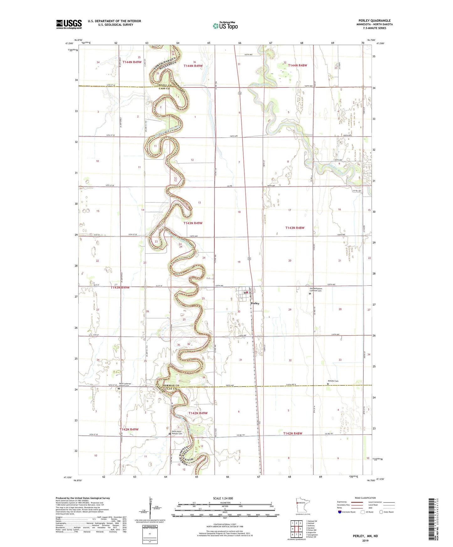
2022 topographic map quadrangle Perley in the states of Minnesota, North Dakota. Scale: 1:24000. Based on the newly updated USGS 7.5' US Topo map series, this map is in the following counties: Norman, Cass, Clay, Traill. The map contains contour data, water features, and other items you are used to seeing on USGS maps, but also has updated roads and other features. This is the next generation of topographic maps. Printed on high-quality waterproof paper with UV fade-resistant inks.
Quads adjacent to this one:
West: Gardner
Northwest: Halstad SW
North: Halstad
Northeast: Anthony
East: Felton NW
Southeast: Felton SW
South: Georgetown
Southwest: Argusville
Contains the following named places: City of Perley, County Ditch Number Five, County Ditch Number Fortyfour, County Ditch Number Fortynine, County Ditch Number Thirteen, Kirkebo Cemetery, Kirkebo Lutheran Church, Love Lake, Mueller Airport, Noble, Nora Church, Nora Lutheran Church Cemetery, North Nora Pioneer Cemetery, Old Bethlehem Lutheran Cemetery, Perley, Perley - Lee Township Fire Department, Perley Post Office, Swenson Airstrip, Township of Lee