MyTopo
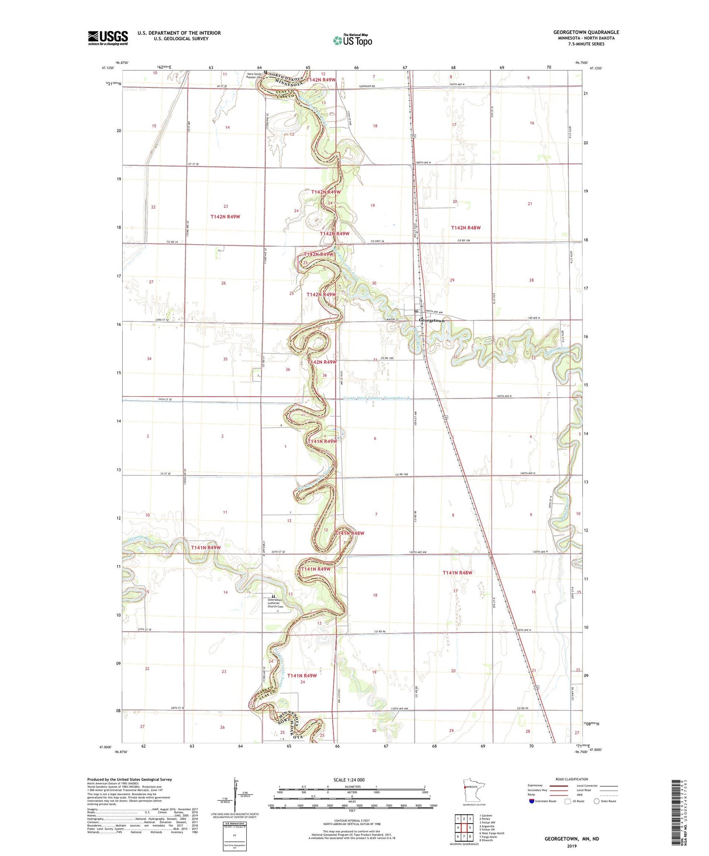
Georgetown Minnesota US Topo Map
Couldn't load pickup availability
2022 topographic map quadrangle Georgetown in the states of Minnesota, North Dakota. Scale: 1:24000. Based on the newly updated USGS 7.5' US Topo map series, this map is in the following counties: Clay, Cass. The map contains contour data, water features, and other items you are used to seeing on USGS maps, but also has updated roads and other features. This is the next generation of topographic maps. Printed on high-quality waterproof paper with UV fade-resistant inks.
Quads adjacent to this one:
West: Argusville
Northwest: Gardner
North: Perley
Northeast: Felton NW
East: Felton SW
Southeast: Dilworth
South: Fargo North
Southwest: West Fargo North
Contains the following named places: Buffalo River, City of Georgetown, County Ditch Number Twentyeight, County Ditch Number Twentythree, County Ditch Number Twentythree B, County Ditch Number Twentytwo, Georgetown, Georgetown Post Office, Hudson's Bay Fur Trading Post Historical Marker, Nora South Pioneer Cemetery, Osterdalen Church, Osterdalen Lutheran Church Cemetery, Saint John's Catholic Church, Sheyenne River, Township of Georgetown, Township of Kragnes, Trysil, Wild Rose Cemetery