MyTopo
Plainview Minnesota US Topo Map
Couldn't load pickup availability
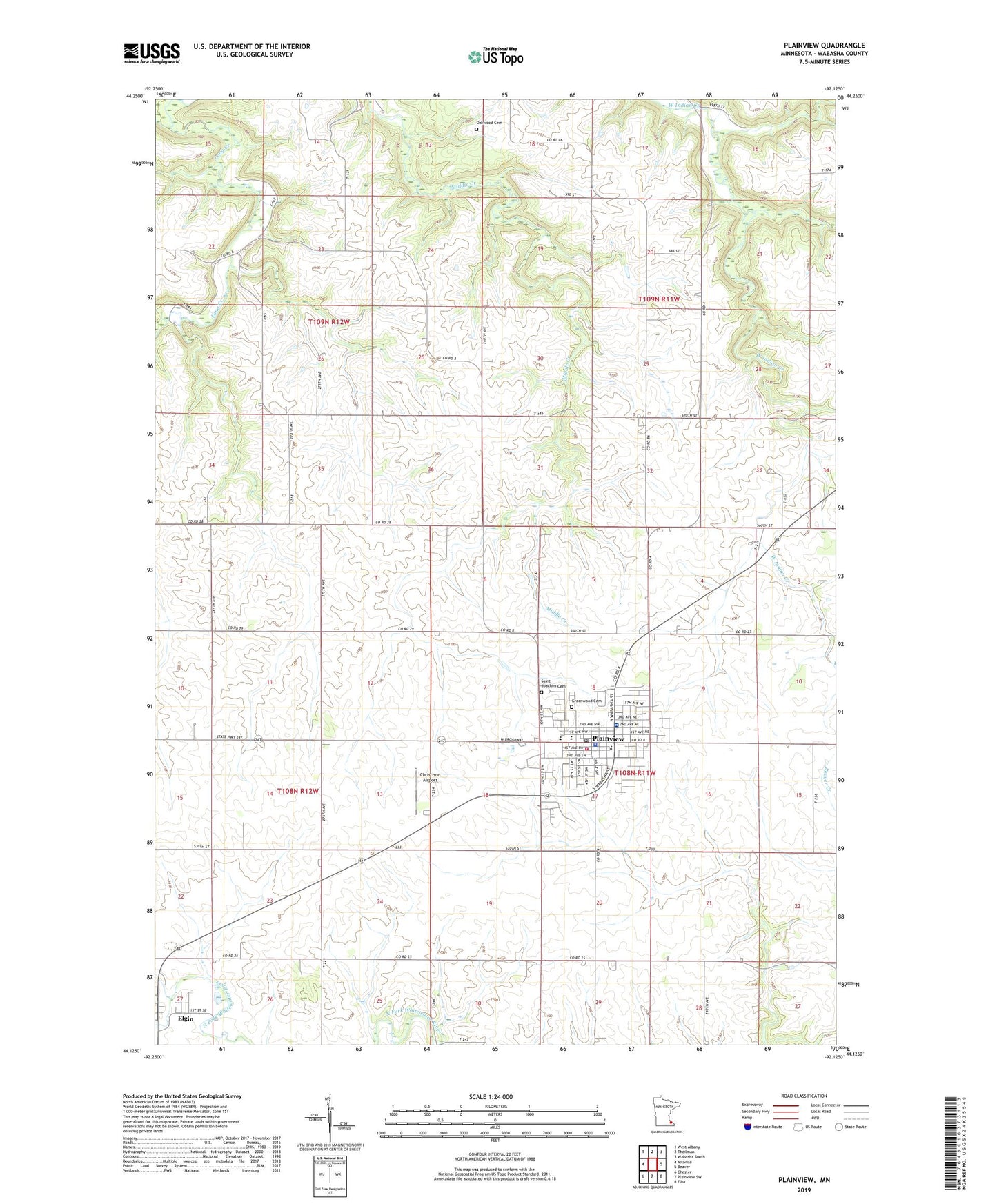
2019 topographic map quadrangle Plainview in the state of Minnesota. Scale: 1:24000. Based on the newly updated USGS 7.5' US Topo map series, this map is in the following counties: Wabasha. The map contains contour data, water features, and other items you are used to seeing on USGS maps, but also has updated roads and other features. This is the next generation of topographic maps. Printed on high-quality waterproof paper with UV fade-resistant inks.
Quads adjacent to this one:
West: Millville
Northwest: West Albany
North: Theilman
Northeast: Wabasha South
East: Beaver
Southeast: Elba
South: Plainview SW
Southwest: Chester
Contains the following named places: Christison Airport, Church of Christ, City of Plainview, Community Presbyterian Church, Dry Creek, Eastwood Park, Eckstein Athletic Field, Frank Pletsch Dam, Good Shepherd Lutheran Church, Greenwood Cemetery, Hillcrest Community Care Center, Hillcrest Park, Holzer Farms, Hunter-Sprenger Pooling Agreement Dam, Immanuel Lutheran Church, Immanuel Lutheran School, Oakwood Cemetery, Olmsted Medical Center, Piper Hills Golf Course, Plainview, Plainview Area History Center, Plainview City Hall, Plainview Clinic Mayo Health, Plainview Elementary School, Plainview Emergency Medical Services, Plainview High School, Plainview Police Department, Plainview Post Office, Plainview Public Library, Plainview Volunteer Fire Department, S Hudell Dam, Saint Joachim Cemetery, Saint Joachim's Catholic Church, Southwest Park, Township of Highland, Township of Oakwood, Township of Plainview, Trinity Evangelical Free Church, Wilmer Schmidt Dam, ZIP Code: 55964