
MyTopo
Plato Minnesota US Topo Map
Couldn't load pickup availability
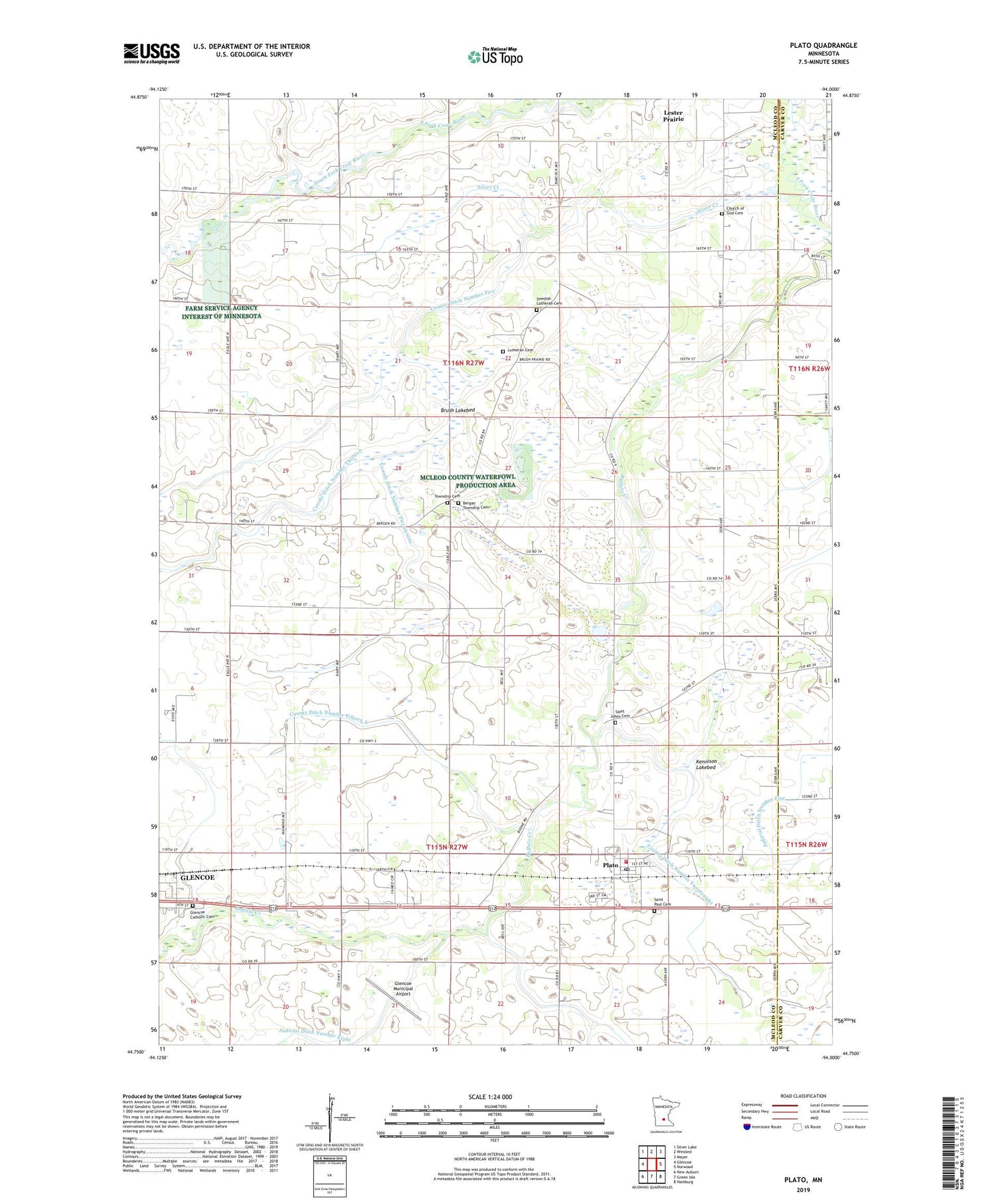
2019 topographic map quadrangle Plato in the state of Minnesota. Scale: 1:24000. Based on the newly updated USGS 7.5' US Topo map series, this map is in the following counties: McLeod, Carver. The map contains contour data, water features, and other items you are used to seeing on USGS maps, but also has updated roads and other features. This is the next generation of topographic maps. Printed on high-quality waterproof paper with UV fade-resistant inks.
Quads adjacent to this one:
West: Glencoe
Northwest: Silver Lake
North: Winsted
Northeast: Mayer
East: Norwood
Southeast: Hamburg
South: Green Isle
Southwest: New Auburn
Contains the following named places: Bergan Township Cemetery, Bergen School, Brush Lakebed, Buffalo Creek County Park, Church of God, Church of God Cemetery, City of Plato, County Ditch Number Fifteen A, County Ditch Number Five, County Ditch Number Thirteen, County Ditch Number Twentyeight, County Ditch Number Twentynine, Crane Creek, Friedens Church, Glencoe Catholic Cemetery, Glencoe Municipal Airport, Judicial Ditch Number Eight, Kennison Lakebed, Lutheran Cemetery, Plato, Plato Baseball Field, Plato Fire Department, Plato Post Office, Plato Siding, Saint Johns Cemetery, Saint John's Lutheran Church, Saint Johns School, Saint Paul Cemetery, Saint Paul's United Church of Christ, School Number 993, Silver Creek, Swedish Church, Swedish Lutheran Cemetery, Township Cemetery, Township of Bergen, Township of Helen, ZIP Code: 55370


