MyTopo
Puposky Lake Minnesota US Topo Map
Couldn't load pickup availability
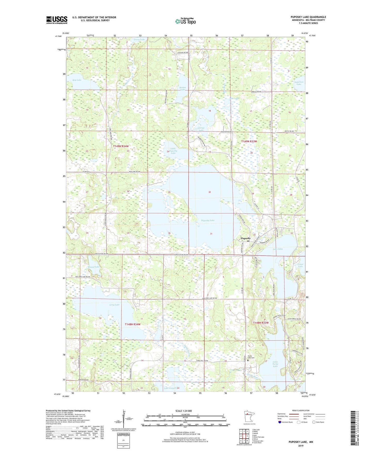
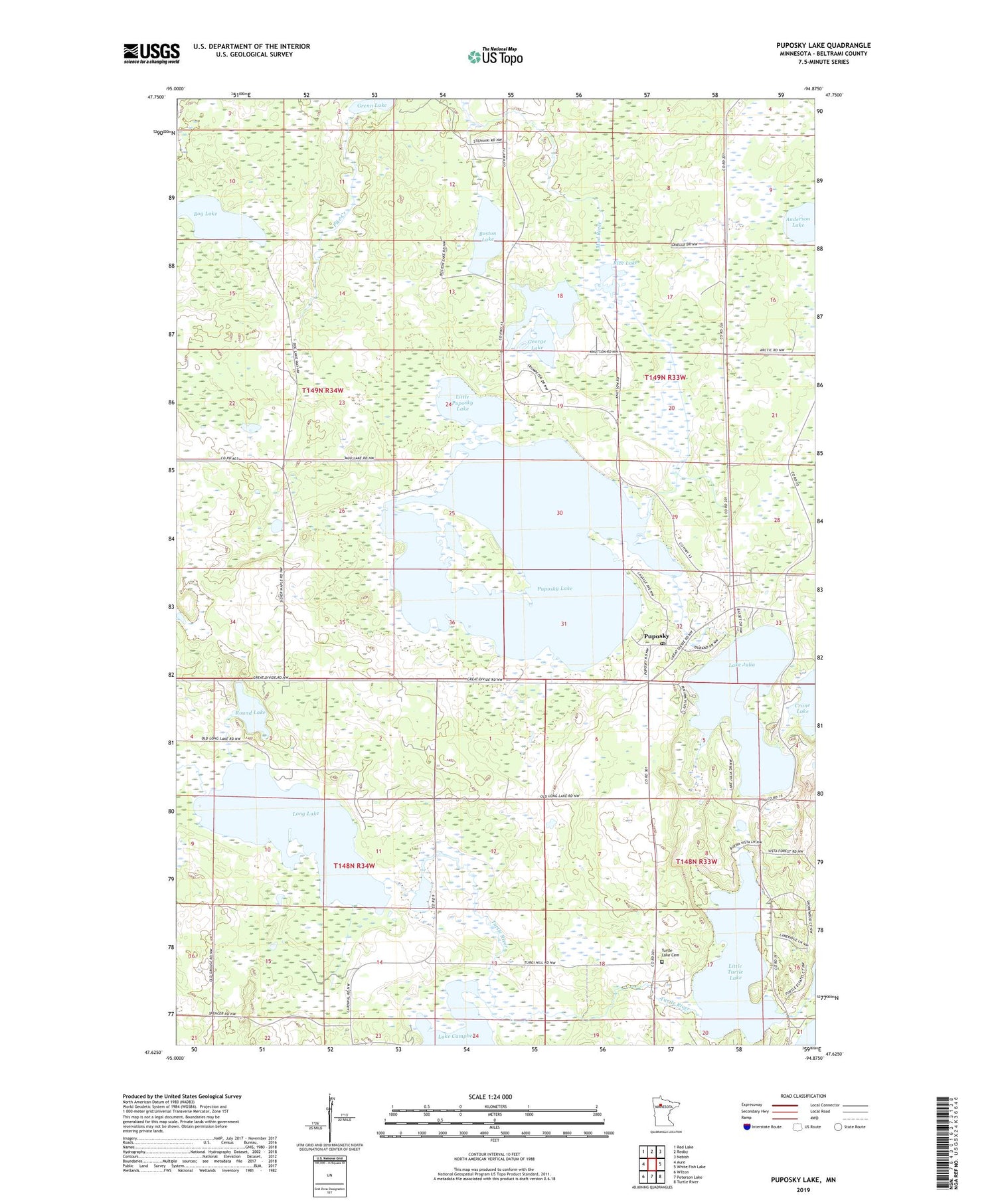
2019 topographic map quadrangle Puposky Lake in the state of Minnesota. Scale: 1:24000. Based on the newly updated USGS 7.5' US Topo map series, this map is in the following counties: Beltrami. The map contains contour data, water features, and other items you are used to seeing on USGS maps, but also has updated roads and other features. This is the next generation of topographic maps. Printed on high-quality waterproof paper with UV fade-resistant inks.
Quads adjacent to this one:
West: Aure
Northwest: Red Lake
North: Redby
Northeast: Nebish
East: White Fish Lake
Southeast: Turtle River
South: Peterson Lake
Southwest: Wilton
Contains the following named places: Anderson Lake, Bog Lake, Boston Lake, Buena Vista Ski Area, Count Beltrami State Monument, Fowlds Post Office, Fowlds Station, George Lake, Lake Julia, Little Puposky Lake, Little Turtle Lake, Long Lake, Long Lake State Wildlife Management Area, Lynx Post Office, Lynx Station, Newhaven Post Office, Newhaven Station, Our Redeemers Lutheran Church, Puposky, Puposky Census Designated Place, Puposky Lake, Puposky Pinewood Lutheran Church, Puposky Post Office, Rice Lake, Round Lake, Saint John's Catholic Church, Township of Liberty, Turtle Lake Township Cemetery, ZIP Code: 56667