MyTopo
White Fish Lake Minnesota US Topo Map
Couldn't load pickup availability
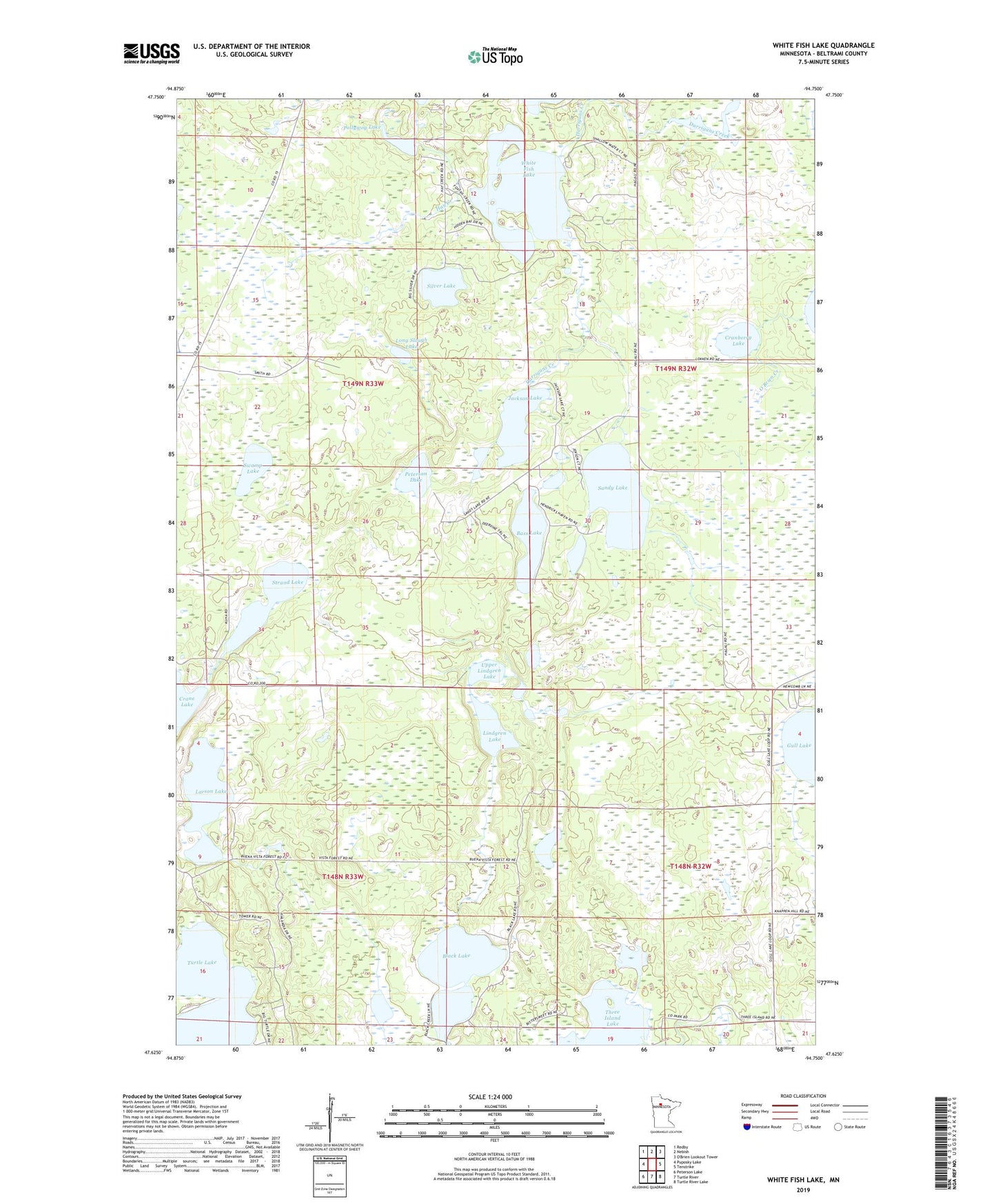
2022 topographic map quadrangle White Fish Lake in the state of Minnesota. Scale: 1:24000. Based on the newly updated USGS 7.5' US Topo map series, this map is in the following counties: Beltrami. The map contains contour data, water features, and other items you are used to seeing on USGS maps, but also has updated roads and other features. This is the next generation of topographic maps. Printed on high-quality waterproof paper with UV fade-resistant inks.
Quads adjacent to this one:
West: Puposky Lake
Northwest: Redby
North: Nebish
East: Tenstrike
Southeast: Turtle River Lake
South: Turtle River
Southwest: Peterson Lake
This map covers the same area as the classic USGS quad with code o47094f7.
Contains the following named places: Bass Lake, Black Lake, Cranberry Lake, Crane Lake, Jackson Lake, Larson Lake, Lindgren Lake, Long Slough Lake, Peterson Lake, Pollywog Lake, Range Line Lake, Sandy Lake, Silver Lake, Strand Lake, Swamp Lake, Three Island Lake County Park, Township of Durand, Township of Turtle Lake, Upper Lindgren Lake, White Fish Lake, ZIP Code: 56683