MyTopo
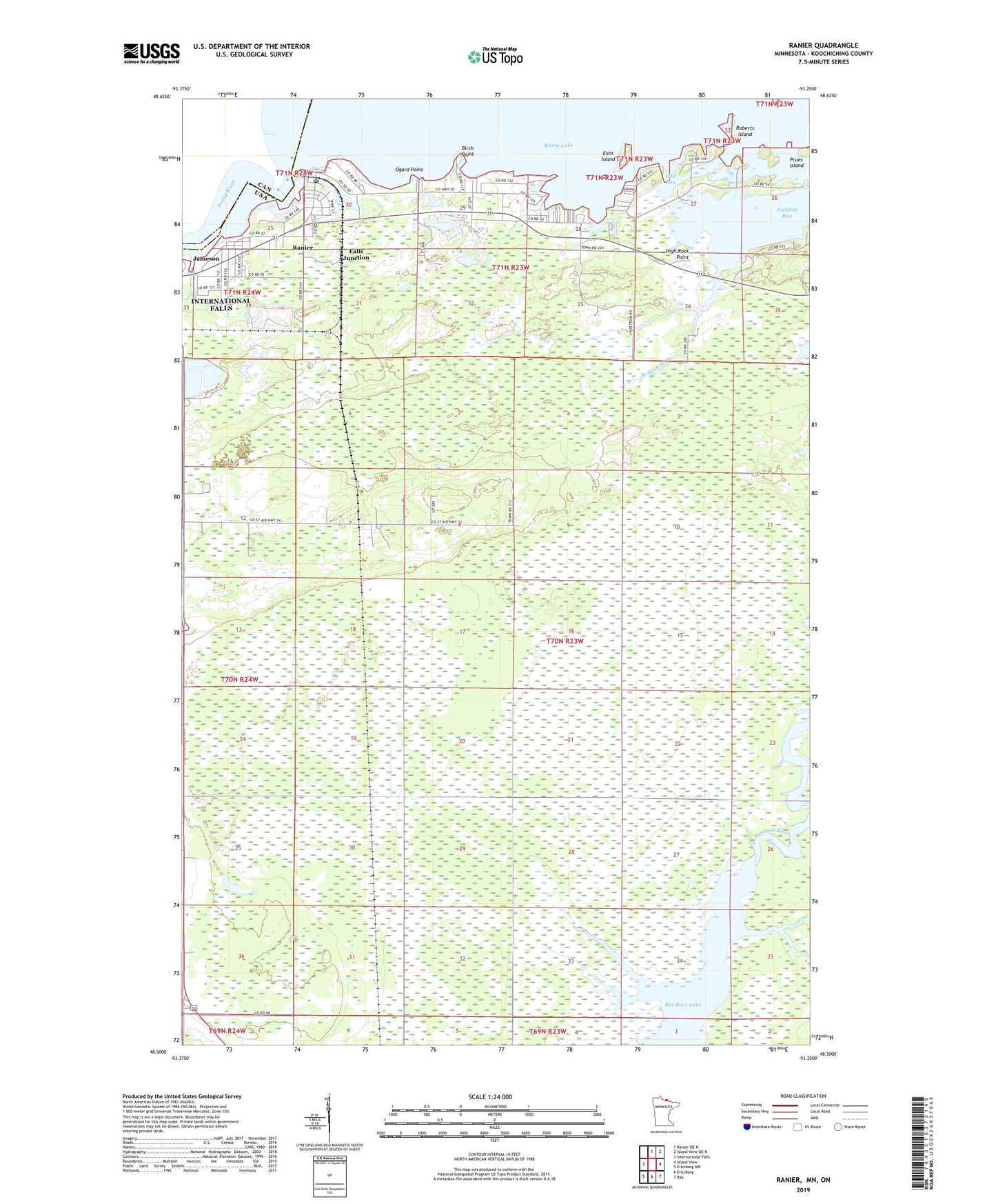
Ranier Minnesota US Topo Map
Couldn't load pickup availability
Also explore the Ranier Forest Service Topo of this same quad for updated USFS data
2022 topographic map quadrangle Ranier in the state of Minnesota. Scale: 1:24000. Based on the newly updated USGS 7.5' US Topo map series, this map is in the following counties: Koochiching. The map contains contour data, water features, and other items you are used to seeing on USGS maps, but also has updated roads and other features. This is the next generation of topographic maps. Printed on high-quality waterproof paper with UV fade-resistant inks.
Quads adjacent to this one:
West: International Falls
North: Ranier OE N
Northeast: Island View OE N
East: Island View
Southeast: Ray
South: Ericsburg
Southwest: Ericsburg NW
This map covers the same area as the classic USGS quad with code o48093e3.
Contains the following named places: Birch Point, City of Ranier, Clarks Park, Elks Bay, Enos Island, Falls Junction, High Rock Point, International Seaplane Base, Jackfish Bay, Jackfish Bay Wayside Park, Jackfish Creek, Jameson, Ogard Point, Point-O-Pines Church, Ranier, Ranier Post Office, Rat Root Lake, Roberts Island, Sand Bay, ZIP Code: 56668