MyTopo
Raymond Minnesota US Topo Map
Couldn't load pickup availability
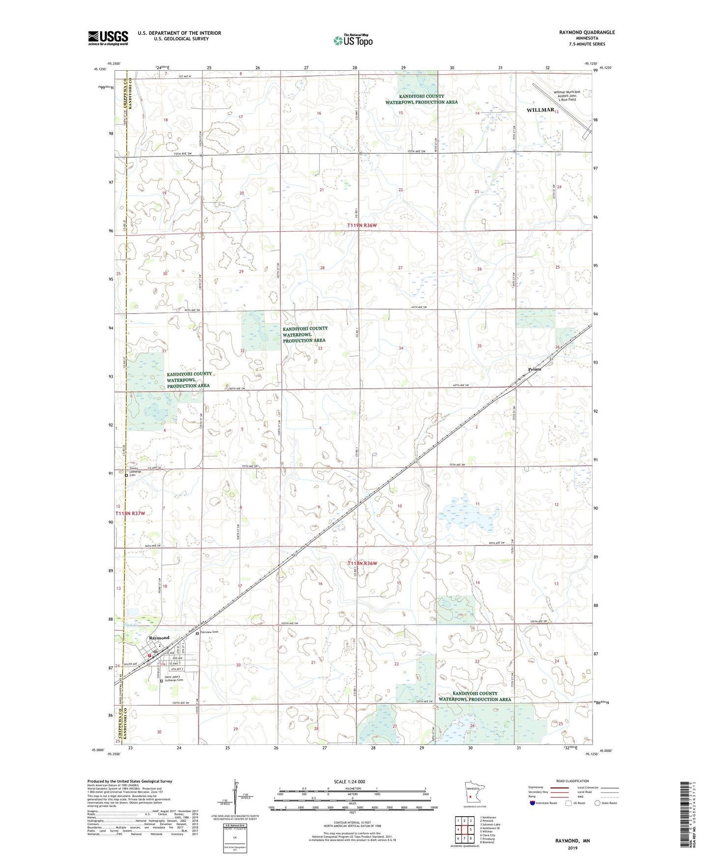
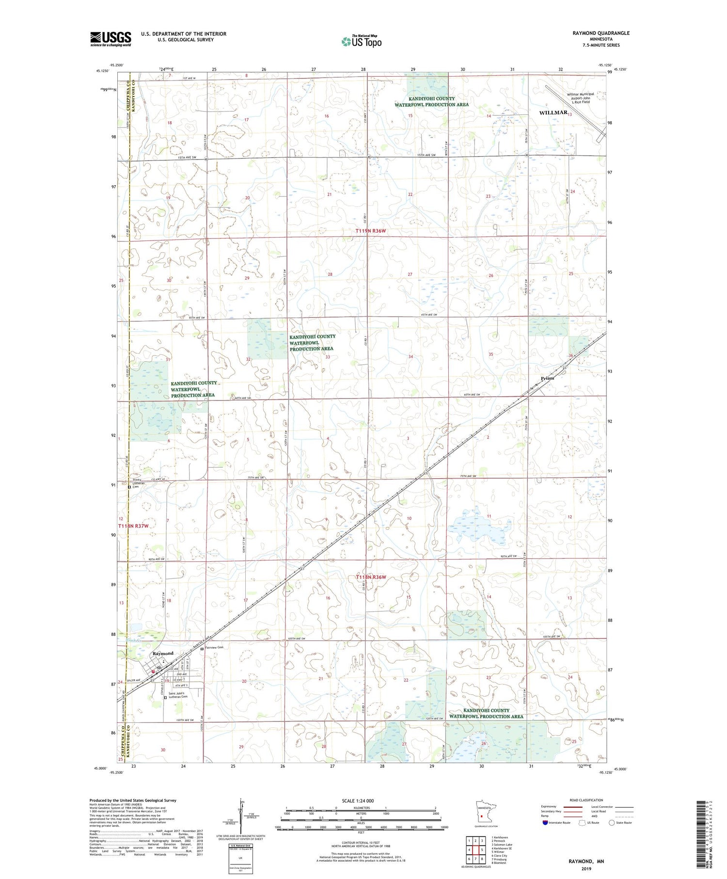
2019 topographic map quadrangle Raymond in the state of Minnesota. Scale: 1:24000. Based on the newly updated USGS 7.5' US Topo map series, this map is in the following counties: Kandiyohi, Chippewa. The map contains contour data, water features, and other items you are used to seeing on USGS maps, but also has updated roads and other features. This is the next generation of topographic maps. Printed on high-quality waterproof paper with UV fade-resistant inks.
Quads adjacent to this one:
West: Kerkhoven SE
Northwest: Kerkhoven
North: Pennock
Northeast: Solomon Lake
East: Willmar
Southeast: Blomkest
South: Prinsburg
Southwest: Clara City
Contains the following named places: City of Raymond, Fairview Cemetery, Golden Grove School, Hawk Creek Country Club, MacCray Elementary School, Olson Lake, Priam, Priam Post Office, Raymond, Raymond Christian Reformed Church, Raymond Fire Department, Raymond Post Office, Raymond Public Library, Saint John's Lutheran Cemetery, Saint Johns Lutheran Church, School Number 809, Township of Edwards, Township of Saint Johns, Trinity Lutheran Cemetery, United Methodist Church, Willmar Municipal Airport-John L Rice Field, ZIP Code: 56282