MyTopo
Reading Minnesota US Topo Map
Couldn't load pickup availability
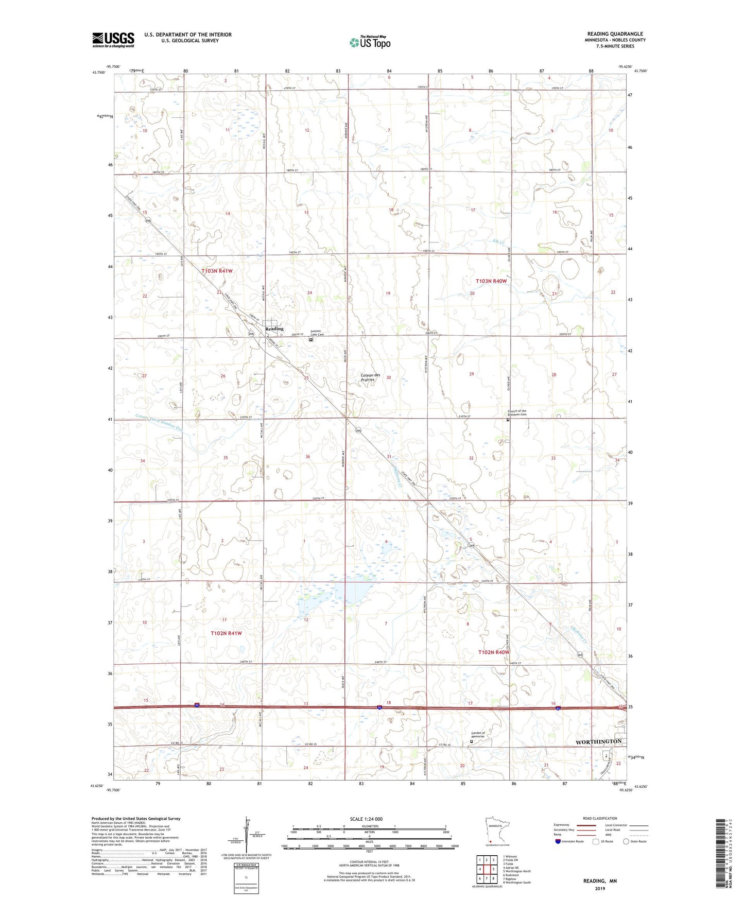
2022 topographic map quadrangle Reading in the state of Minnesota. Scale: 1:24000. Based on the newly updated USGS 7.5' US Topo map series, this map is in the following counties: Nobles. The map contains contour data, water features, and other items you are used to seeing on USGS maps, but also has updated roads and other features. This is the next generation of topographic maps. Printed on high-quality waterproof paper with UV fade-resistant inks.
Quads adjacent to this one:
West: Adrian NE
Northwest: Wilmont
North: Fulda SW
Northeast: Fulda
East: Worthington North
Southeast: Worthington South
South: Bigelow
Southwest: Rushmore
This map covers the same area as the classic USGS quad with code o43095f6.
Contains the following named places: Bethel Presbyterian Church, Brethren Church, Church of the Brethren Cemetery, County Ditch Number Five, Garden of Memories, Herlein-Boote State Wildlife Management Area, KWOA-AM (Worthington), KWOA-FM (Worthington), Prairie View Golf Links, Reading, Reading Post Office, Summit Lake Cemetery, Township of Elk, Township of Worthington, Worthington Junior High School, ZIP Code: 56165