MyTopo
Fulda SW Minnesota US Topo Map
Couldn't load pickup availability
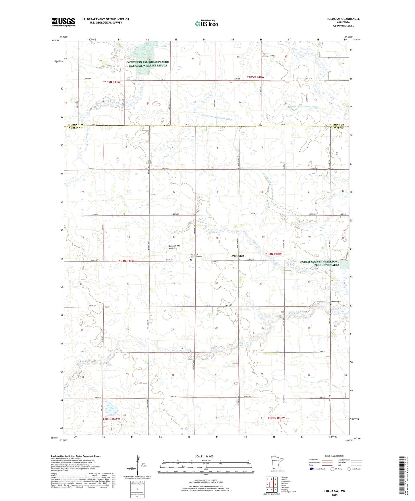
2022 topographic map quadrangle Fulda SW in the state of Minnesota. Scale: 1:24000. Based on the newly updated USGS 7.5' US Topo map series, this map is in the following counties: Nobles, Murray. The map contains contour data, water features, and other items you are used to seeing on USGS maps, but also has updated roads and other features. This is the next generation of topographic maps. Printed on high-quality waterproof paper with UV fade-resistant inks.
Quads adjacent to this one:
West: Wilmont
Northwest: Slayton
North: Avoca
Northeast: Lime Creek
East: Fulda
Southeast: Worthington North
South: Reading
Southwest: Adrian NE
This map covers the same area as the classic USGS quad with code o43095g6.
Contains the following named places: American Lutheran Cemetery, County Ditch Number Eighty, Desiltation Project 73-2 Dam, Groth State Wildlife Management Area, Immanuel Church, Judicial Ditch Number Twelve, Judicial Ditch Number Twenty, Kremer-Leiner-Goedtke Pond Dam, Pfingsten, Pfingston Post Office, Pheasant Run State Wildlife Management Area, Seward Cemetery, Stable Banks State Wildlife Management Area, Township of Seward