MyTopo
Rollingstone Minnesota US Topo Map
Couldn't load pickup availability
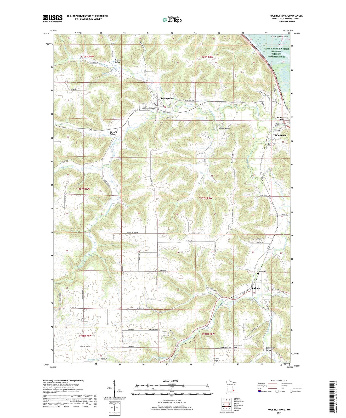
2019 topographic map quadrangle Rollingstone in the state of Minnesota. Scale: 1:24000. Based on the newly updated USGS 7.5' US Topo map series, this map is in the following counties: Winona. The map contains contour data, water features, and other items you are used to seeing on USGS maps, but also has updated roads and other features. This is the next generation of topographic maps. Printed on high-quality waterproof paper with UV fade-resistant inks.
Quads adjacent to this one:
West: Altura
Northwest: Weaver
North: Cochrane
Northeast: Fountain City
East: Winona West
Southeast: Wilson
South: Lewiston
Southwest: Utica
Contains the following named places: Arches Museum, Bear Creek, Boller Pool, Boller Pool Dam, City of Minnesota City, City of Rollingstone, City of Stockton, Dark Slough, Francis Speltz Dam, Grace Lutheran Church, Herb Speltz Detention Number 2 Dam, Hidden Valley Mobile Home Village, Holy Trinity Catholic Church, Immanuel Lutheran Church, Immanuel School, Lloyd Haxton Dam, Mecklenburg Cemetery, Middle Valley, Minnesota City Village Hall, Oakland Cemetery, Preston Valley, Rollingstone, Rollingstone Creek, Rollingstone Elementary School, Rollingstone Fire and Rescue Department, Rollingstone Luxembourg Heritage Museum, Rollingstone Post Office, Saint Paul's Catholic Parish, Schoeniger Valley, Speltz, Speltz Creek, Stockton, Stockton Post Office, Stockton Valley, Stockton Valley Creek, Straight Slough, Straight Valley, The Arches, Township of Hillsdale, Township of Rollingstone, ZIP Code: 55959