MyTopo
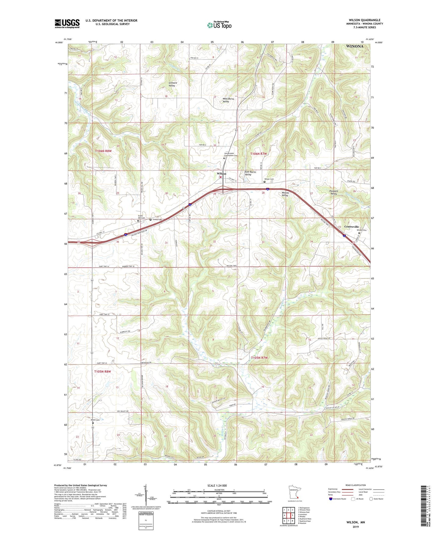
Wilson Minnesota US Topo Map
Couldn't load pickup availability
2022 topographic map quadrangle Wilson in the state of Minnesota. Scale: 1:24000. Based on the newly updated USGS 7.5' US Topo map series, this map is in the following counties: Winona. The map contains contour data, water features, and other items you are used to seeing on USGS maps, but also has updated roads and other features. This is the next generation of topographic maps. Printed on high-quality waterproof paper with UV fade-resistant inks.
Quads adjacent to this one:
West: Lewiston
Northwest: Rollingstone
North: Winona West
Northeast: Winona East
East: Witoka
Southeast: Houston
South: Rushford East
Southwest: Rushford West
This map covers the same area as the classic USGS quad with code o43091h6.
Contains the following named places: Brand Cemetery, Camp We-Na-Nah, Centerville, Clement Felix Detention Structure Dam, Frank Hill Cemetery, Hart, Immaculate Conception Cemetery, Immaculate Conception Church, L and D Dairy, Saint Johns Church, Township of Wilson, Township of Wiscoy, Trinity Cemetery, Trinity Church, Wilson, Wilson Cemetery, Wilson Post Office, Wilson Volunteer Fire Department, Witoka Cemetery, ZIP Code: 55987