MyTopo
Lewiston Minnesota US Topo Map
Couldn't load pickup availability
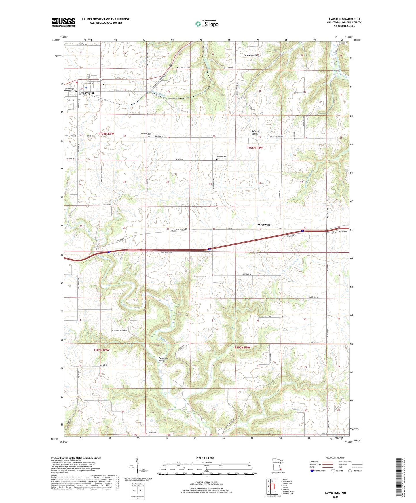
2022 topographic map quadrangle Lewiston in the state of Minnesota. Scale: 1:24000. Based on the newly updated USGS 7.5' US Topo map series, this map is in the following counties: Winona. The map contains contour data, water features, and other items you are used to seeing on USGS maps, but also has updated roads and other features. This is the next generation of topographic maps. Printed on high-quality waterproof paper with UV fade-resistant inks.
Quads adjacent to this one:
West: Utica
Northwest: Altura
North: Rollingstone
Northeast: Winona West
East: Wilson
Southeast: Rushford East
South: Rushford West
Southwest: Arendahl
This map covers the same area as the classic USGS quad with code o43091h7.
Contains the following named places: Barkeim Farms, Brethren Cemetery, Brethren Church, City of Lewiston, Enterprise East Bound Rest Area, Farmers Community Park, Ferguson Valley, Geology of Southeastern Minnesota Historical Marker, German Ridge, Lewiston, Lewiston City Hall, Lewiston Clinic, Lewiston Country Club, Lewiston Elementary School, Lewiston Police Department, Lewiston Post Office, Lewiston School, Lewiston Volunteer Fire Department, Peterson Creek, Presbyterian Church, Saint John's Evangelical Church, Saint John's Lutheran School, Saint Pauls Lutheran Church, Saint Rose of Lima Catholic Church, Saints Peter and Paul Church, Township of Hart, Township of Warren, Warren Cemetery, Warren Township Road Structure Dam, Winona County, Wyattville, Wyattville Post Office, ZIP Code: 55952