MyTopo
Ross Lake Minnesota US Topo Map
Couldn't load pickup availability
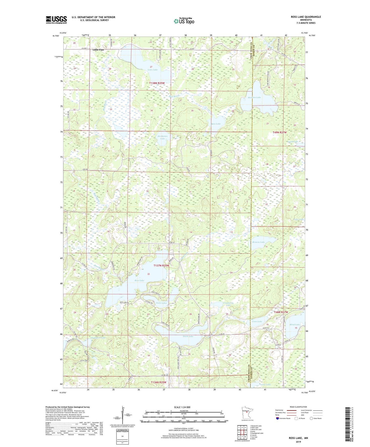
2019 topographic map quadrangle Ross Lake in the state of Minnesota. Scale: 1:24000. Based on the newly updated USGS 7.5' US Topo map series, this map is in the following counties: Crow Wing, Aitkin. The map contains contour data, water features, and other items you are used to seeing on USGS maps, but also has updated roads and other features. This is the next generation of topographic maps. Printed on high-quality waterproof paper with UV fade-resistant inks.
Quads adjacent to this one:
West: Emily
Northwest: Roosevelt Lake
North: Edna Lake
Northeast: White Elk Lake
East: Esquagamah Lake
Southeast: Aitkin
South: Iron Hub
Southwest: Cuyuna
Contains the following named places: Bass Lake, Birchdale Lake, Birchdale Lake Dam, Birchdale State Wildlife Management Area, Browns Lake, Cartie Lake, Coon Lake, Cranberry Lake, Johnson Creek, Little Pine, Little Pine Creek Dam, Littlepine Post Office, Lows Lake, Moulton Lake, Ross Brook, Ross Lake, Smith Lake, Snodgrass Lake, Stark Lake, Thompson Lake, Township of Ross Lake, Twin Lakes