MyTopo
Sawbill Landing Minnesota US Topo Map
Couldn't load pickup availability
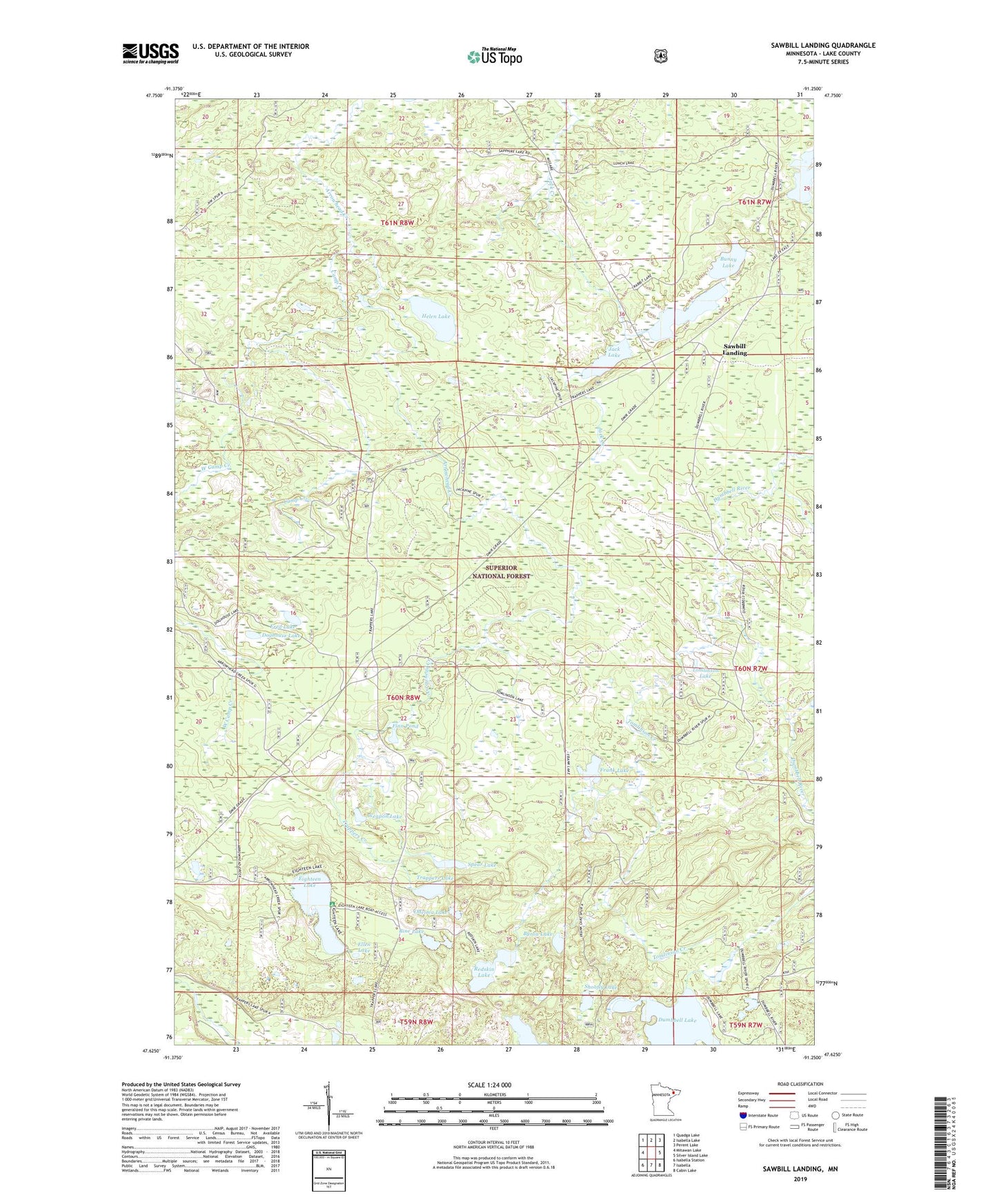
2019 topographic map quadrangle Sawbill Landing in the state of Minnesota. Scale: 1:24000. Based on the newly updated USGS 7.5' US Topo map series, this map is in the following counties: Lake. The map contains contour data, water features, and other items you are used to seeing on USGS maps, but also has updated roads and other features. This is the next generation of topographic maps. Printed on high-quality waterproof paper with UV fade-resistant inks.
Quads adjacent to this one:
West: Mitawan Lake
Northwest: Quadga Lake
North: Isabella Lake
Northeast: Perent Lake
East: Silver Island Lake
Southeast: Cabin Lake
South: Isabella
Southwest: Isabella Station
Contains the following named places: Bine Lake, Bunny Lake, Byron Lake, Camp Creek, Doghouse Lake, Eighteen Lake, Ellen Lake, Finn Pond, Frank Lake, Fred Lake, Helen Lake, Jack Lake, Kelly Landing, Long Lake Camp, Long Lake School, Martin Landing, Odeima Lake, Redskin Lake, Sawbill Landing, Sawbill Landing Post Office, Shoofly Lake, Spear Lake, Sylvania Lake, Tomlinson Creek, Tomlinson Lake, Trappers Creek, Trappers Lake, Weapon Lake, West Camp Creek, Wheeler Landing