MyTopo
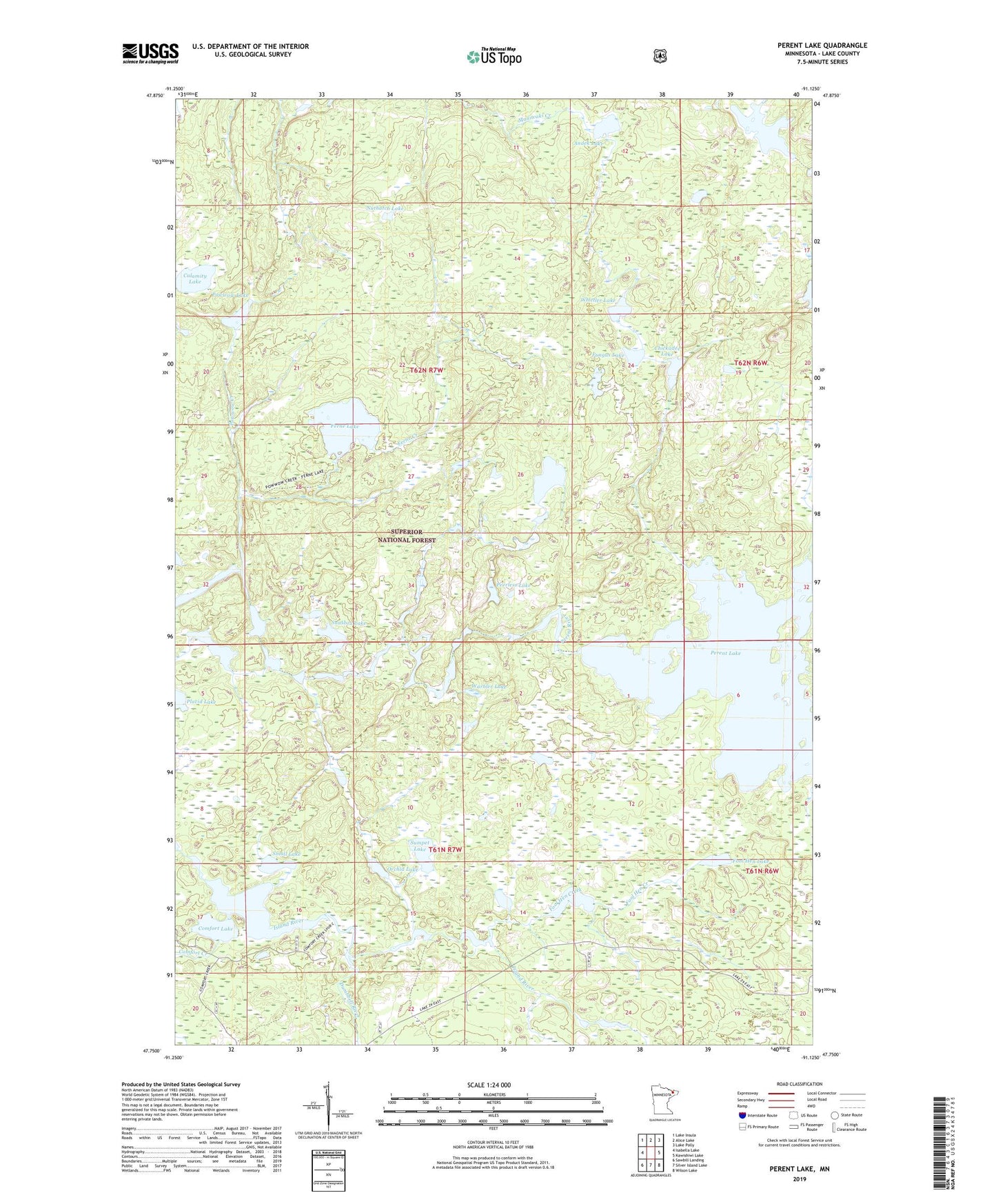
Perent Lake Minnesota US Topo Map
Couldn't load pickup availability
Also explore the Perent Lake Forest Service Topo of this same quad for updated USFS data
2022 topographic map quadrangle Perent Lake in the state of Minnesota. Scale: 1:24000. Based on the newly updated USGS 7.5' US Topo map series, this map is in the following counties: Lake. The map contains contour data, water features, and other items you are used to seeing on USGS maps, but also has updated roads and other features. This is the next generation of topographic maps. Printed on high-quality waterproof paper with UV fade-resistant inks.
Quads adjacent to this one:
West: Isabella Lake
Northwest: Lake Insula
North: Alice Lake
Northeast: Lake Polly
East: Kawishiwi Lake
Southeast: Wilson Lake
South: Silver Island Lake
Southwest: Sawbill Landing
This map covers the same area as the classic USGS quad with code o47091g2.
Contains the following named places: Albino Lake, Andek Lake, Baskatong Lake, Calamity Lake, Chickadee Lake, Comfort Creek, Comfort Lake, Dumbbell River, Ferne Creek, Ferne Lake, Fool Hen Creek, Fool Hen Lake, Fungus Lake, Nuthatch Lake, Orchid Lake, Peerless Lake, Perent Lake, Placid Lake, Pompous Lake, Powwow Creek, Powwow Lake, Small Lake, Snusbox Lake, Sumpet Lake, Tomahawk Lake, Warbler Lake, Whittler Lake