MyTopo
Quadga Lake Minnesota US Topo Map
Couldn't load pickup availability
Also explore the Quadga Lake Forest Service Topo of this same quad for updated USFS data
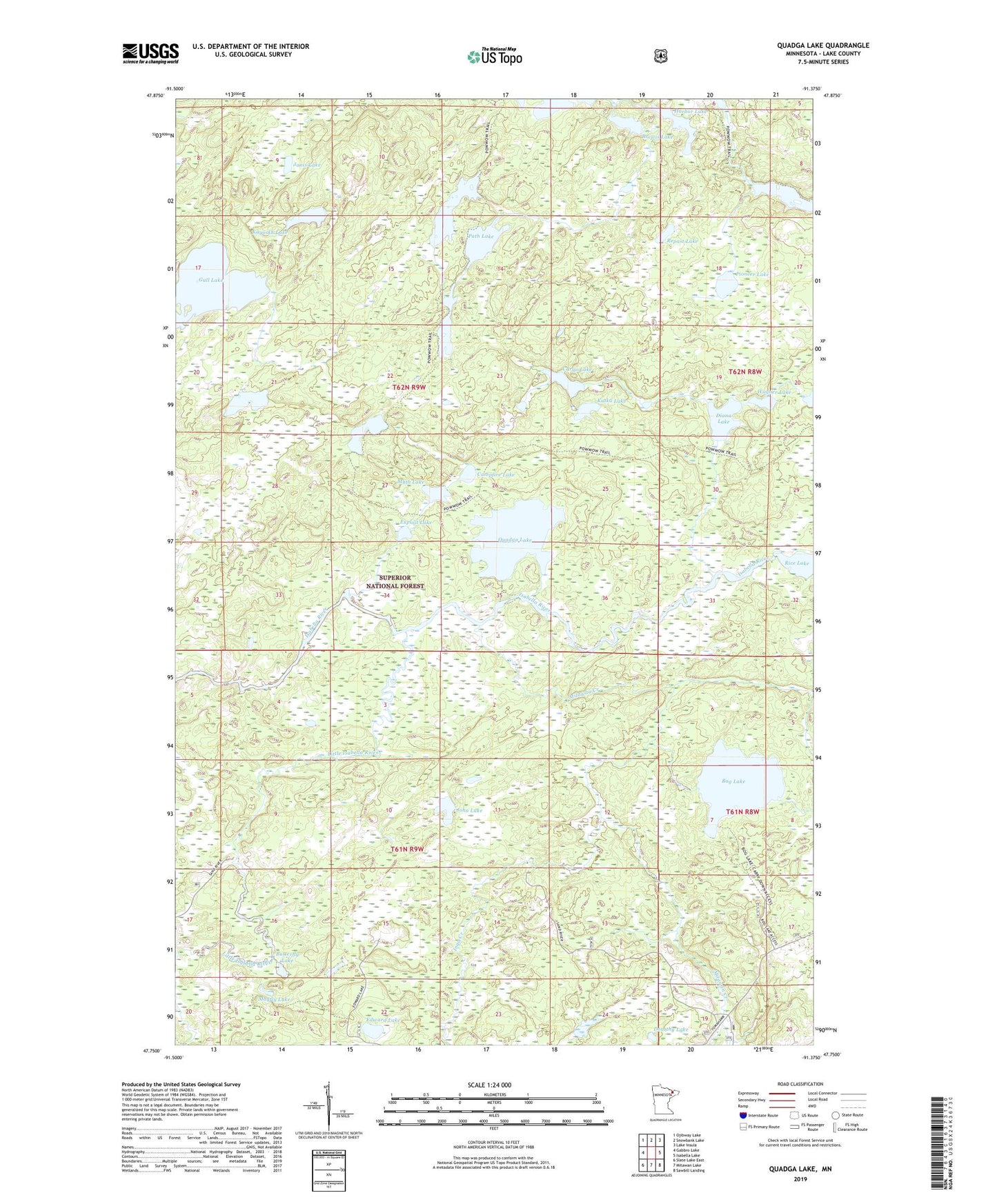
2022 topographic map quadrangle Quadga Lake in the state of Minnesota. Scale: 1:24000. Based on the newly updated USGS 7.5' US Topo map series, this map is in the following counties: Lake. The map contains contour data, water features, and other items you are used to seeing on USGS maps, but also has updated roads and other features. This is the next generation of topographic maps. Printed on high-quality waterproof paper with UV fade-resistant inks.
Quads adjacent to this one:
West: Gabbro Lake
Northwest: Ojibway Lake
North: Snowbank Lake
Northeast: Lake Insula
East: Isabella Lake
Southeast: Sawbill Landing
South: Mitawan Lake
Southwest: Slate Lake East
This map covers the same area as the classic USGS quad with code o47091g4.
Contains the following named places: Bog Lake, Brewis Lake, Butterfly Lake, Campfire Lake, Cargo Lake, Diana Lake, Dorothy Lake, Edward Lake, Exploit Lake, Harbor Lake, Horseshoe Lake, Inga Creek, Jack Pine Creek, Janis Lake, John Lake, Kayoskh Lake, Kutka Lake, Little Isabella River, Mayfly Lake, Mirror Lake, Mitawan Creek, Myth Lake, Path Lake, Phospor Lake, Pioneer Lake, Quadga Lake, Repast Lake, Rock of Ages Lake, South Wilder Lake, Superstition Creek, Superstition Lake, Wagner Lake