MyTopo
Isabella Lake Minnesota US Topo Map
Couldn't load pickup availability
Also explore the Isabella Lake Forest Service Topo of this same quad for updated USFS data
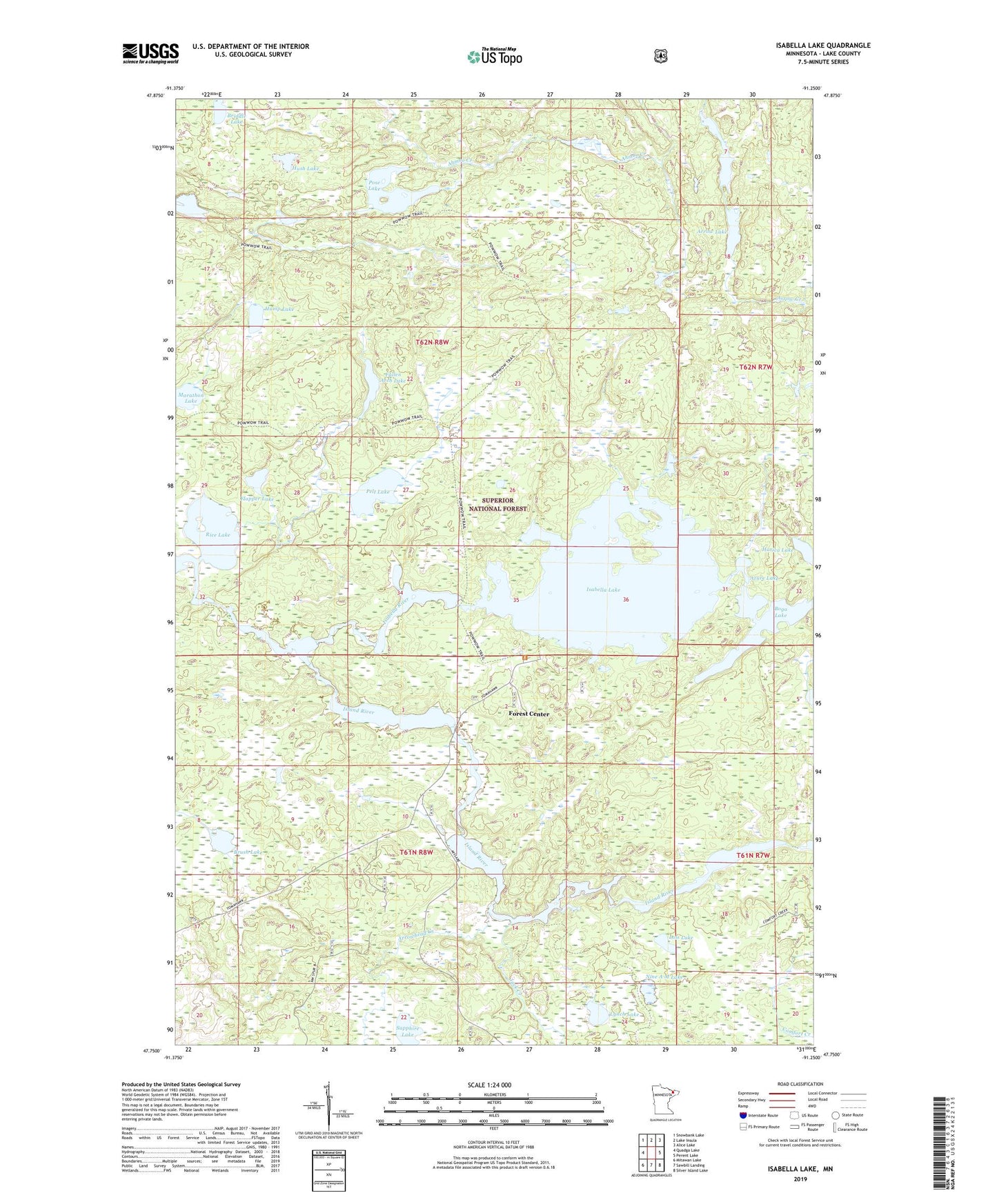
2022 topographic map quadrangle Isabella Lake in the state of Minnesota. Scale: 1:24000. Based on the newly updated USGS 7.5' US Topo map series, this map is in the following counties: Lake. The map contains contour data, water features, and other items you are used to seeing on USGS maps, but also has updated roads and other features. This is the next generation of topographic maps. Printed on high-quality waterproof paper with UV fade-resistant inks.
Quads adjacent to this one:
West: Quadga Lake
Northwest: Snowbank Lake
North: Lake Insula
Northeast: Alice Lake
East: Perent Lake
Southeast: Silver Island Lake
South: Sawbill Landing
Southwest: Mitawan Lake
This map covers the same area as the classic USGS quad with code o47091g3.
Contains the following named places: Arrow Creek, Arrow Lake, Arrow Lookout Tower, Arrowhead Creek, Azure Lake, Boga Lake, Briddle Lake, Brush Lake, Fallen Arch Lake, Flapper Lake, Forest Center, Forest Center Post Office, Harica Lake, Hump Lake, Hush Lake, Isabella Lake, Isabella Lake State Forest, Island River, Jack Creek, Lois Lake, Lynch Lake, Marathon Lake, Nine A M Lake, Pelt Lake, Perent River, Pose Lake, Powwoun Trail, Rap Lake, Rice Lake, Sapphire Lake