MyTopo
Shieldsville Minnesota US Topo Map
Couldn't load pickup availability
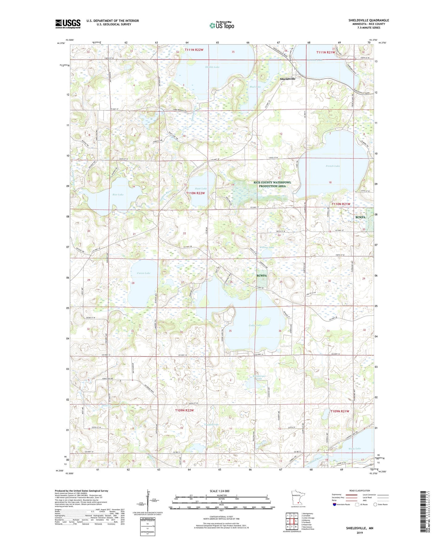
2019 topographic map quadrangle Shieldsville in the state of Minnesota. Scale: 1:24000. Based on the newly updated USGS 7.5' US Topo map series, this map is in the following counties: Rice. The map contains contour data, water features, and other items you are used to seeing on USGS maps, but also has updated roads and other features. This is the next generation of topographic maps. Printed on high-quality waterproof paper with UV fade-resistant inks.
Quads adjacent to this one:
West: Kilkenny
Northwest: Montgomery
North: Lonsdale
Northeast: Little Chicago
East: Faribault
Southeast: Medford West
South: Morristown
Southwest: Waterville
Contains the following named places: Apple Creek Orchard, Caron Lake, Cedar Lake, Crawford Lake, Fox Hill Farm, French Lake, Hunt Lake, Kennyville School, Lake View School, Mazaska Lake, Mud Lake, North Cedar Lake School, Rice Lake, Rice Lake Dam, School Number 1797, Shields Lake, Shieldsville, Township of Shieldsville, Trebon School, Trinity Lutheran School, Trinity School, Warsaw Census Designated Place, Weinberger Lake, Willing Lake