MyTopo
Waterville Minnesota US Topo Map
Couldn't load pickup availability
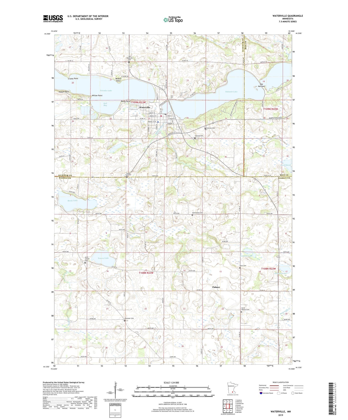
2022 topographic map quadrangle Waterville in the state of Minnesota. Scale: 1:24000. Based on the newly updated USGS 7.5' US Topo map series, this map is in the following counties: Waseca, Le Sueur, Rice. The map contains contour data, water features, and other items you are used to seeing on USGS maps, but also has updated roads and other features. This is the next generation of topographic maps. Printed on high-quality waterproof paper with UV fade-resistant inks.
Quads adjacent to this one:
West: Elysian
Northwest: Cordova
North: Kilkenny
Northeast: Shieldsville
East: Morristown
Southeast: Meriden
South: Waseca
Southwest: Janesville
This map covers the same area as the classic USGS quad with code o44093b5.
Contains the following named places: Antl Bay, Calvary Cemetery, Cannon Gate Park, City of Waterville, County Line Cemetery, Crams Point, Ebenezer Cemetery, Everson Lake, First Baptist Church, Hobans Point, Holy Trinity Catholic Church, Iosco Cemetery, Kamp Dells, Knutsen Lake, McPete Point, North Waseca Cemetery, North Waseca Church, Palmer, Palmer Post Office, Pommerans Cemetery, Reeds Lake, Rocky Point, Saint Andrews Episcopal Church, Saint Jarlath Cemetery, Saint Jarlath Church, Sakatah Cemetery, Sakatah Lake, Sakatah State Park, Scott's Campground, Silver Creek, Tetonka Dam, Tetonka Lake, The Narrows, Toners Lake, Township of Iosco, Township of Waterville, Trinity Lutheran Church, United Methodist Church, Van Blaracom Cemetery, Waseca Area Medical Center, Waterville, Waterville - Elysian - Morristown Senior High School, Waterville City Hall, Waterville Creek, Waterville Elementary School, Waterville Fire Department, Waterville Good Samaritan Center, Waterville High School, Waterville Police Department, Waterville Post Office, Waterville Public Library, White Water Creek, Willow Point, ZIP Code: 56096