
MyTopo
Spicer Minnesota US Topo Map
Couldn't load pickup availability
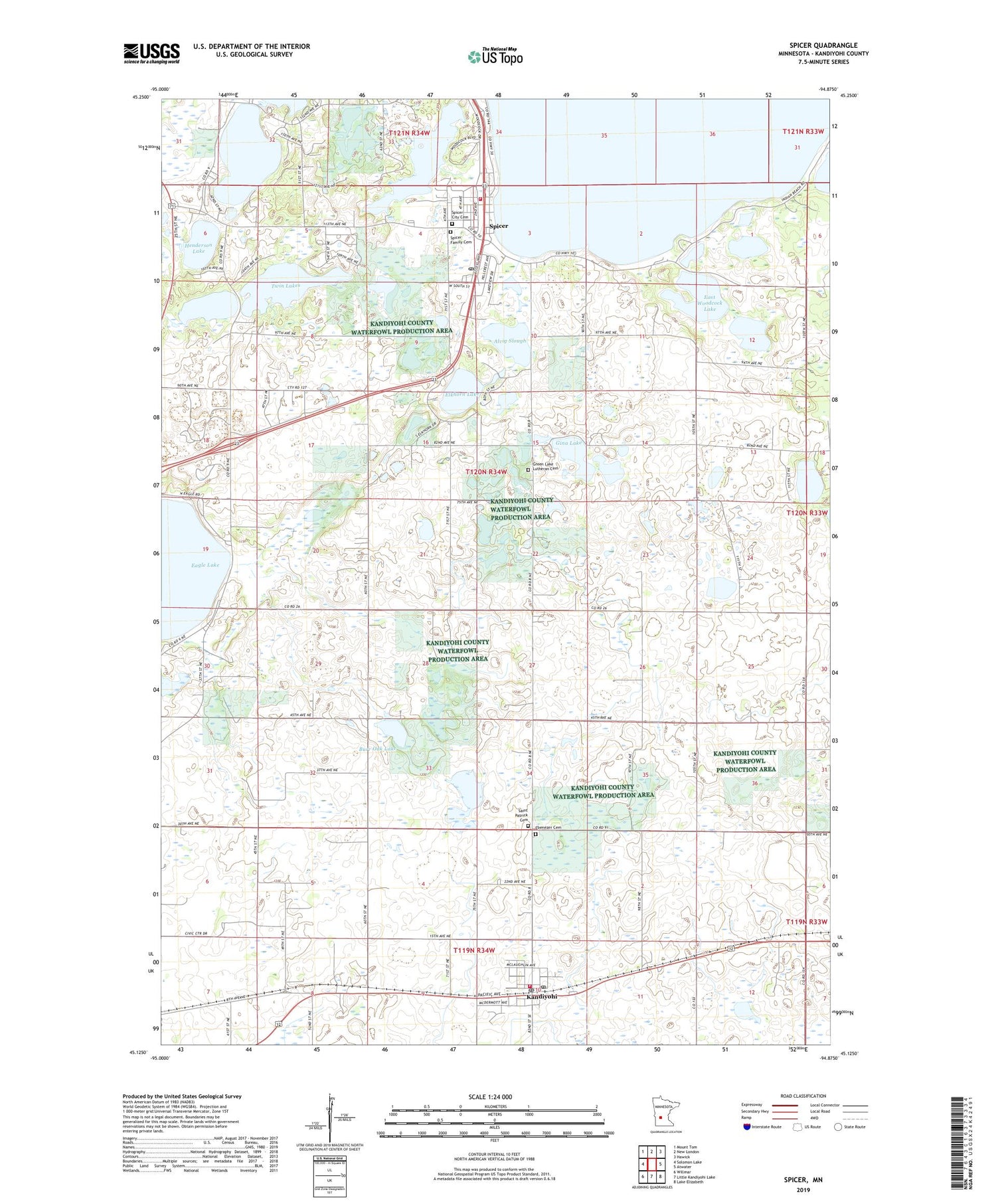
2019 topographic map quadrangle Spicer in the state of Minnesota. Scale: 1:24000. Based on the newly updated USGS 7.5' US Topo map series, this map is in the following counties: Kandiyohi. The map contains contour data, water features, and other items you are used to seeing on USGS maps, but also has updated roads and other features. This is the next generation of topographic maps. Printed on high-quality waterproof paper with UV fade-resistant inks.
Quads adjacent to this one:
West: Solomon Lake
Northwest: Mount Tom
North: New London
Northeast: Hawick
East: Atwater
Southeast: Lake Elizabeth
South: Little Kandiyohi Lake
Southwest: Willmar
Contains the following named places: Alvig Slough, Bass Lake, Burr Oak Lake, Carlson Lake, Church of Christ, City of Kandiyohi, City of Spicer, Decision Hills Camp, Downs Lake, Eagle Lake State Wildlife Management Area, East Woodcock Lake, Ebenezer Cemetery, Ebenezer Lutheran Church, Elkhorn Lake, Elkhorn Lake Rearing Pond Dam, Faith Lutheran Church, George Lake, Gina Lake, Green Lake Baseball Diamonds, Green Lake Camp, Green Lake Church, Green Lake Lutheran Cemetery, Green Lake Mall, Henderson Lake, Kandi State Wildlife Management Area, Kandiyohi, Kandiyohi Fire Department, Kandiyohi Post Office, Saint Patrick Catholic Church, Saint Patrick Cemetery, School Number 28, School Number 44, School Number 51, School Number 60, School Number 78, Spicer, Spicer City Cemetery, Spicer City Hall, Spicer City Park, Spicer Family Cemetery, Spicer Fire Department, Spicer Health Center, Spicer Library, Spicer Post Office, Thompson Lake, Township of Green Lake, Twin Lakes, Woodcock Lake, Yohi State Wildlife Management Area, ZIP Codes: 56251, 56288


