MyTopo
Star Lake Minnesota US Topo Map
Couldn't load pickup availability
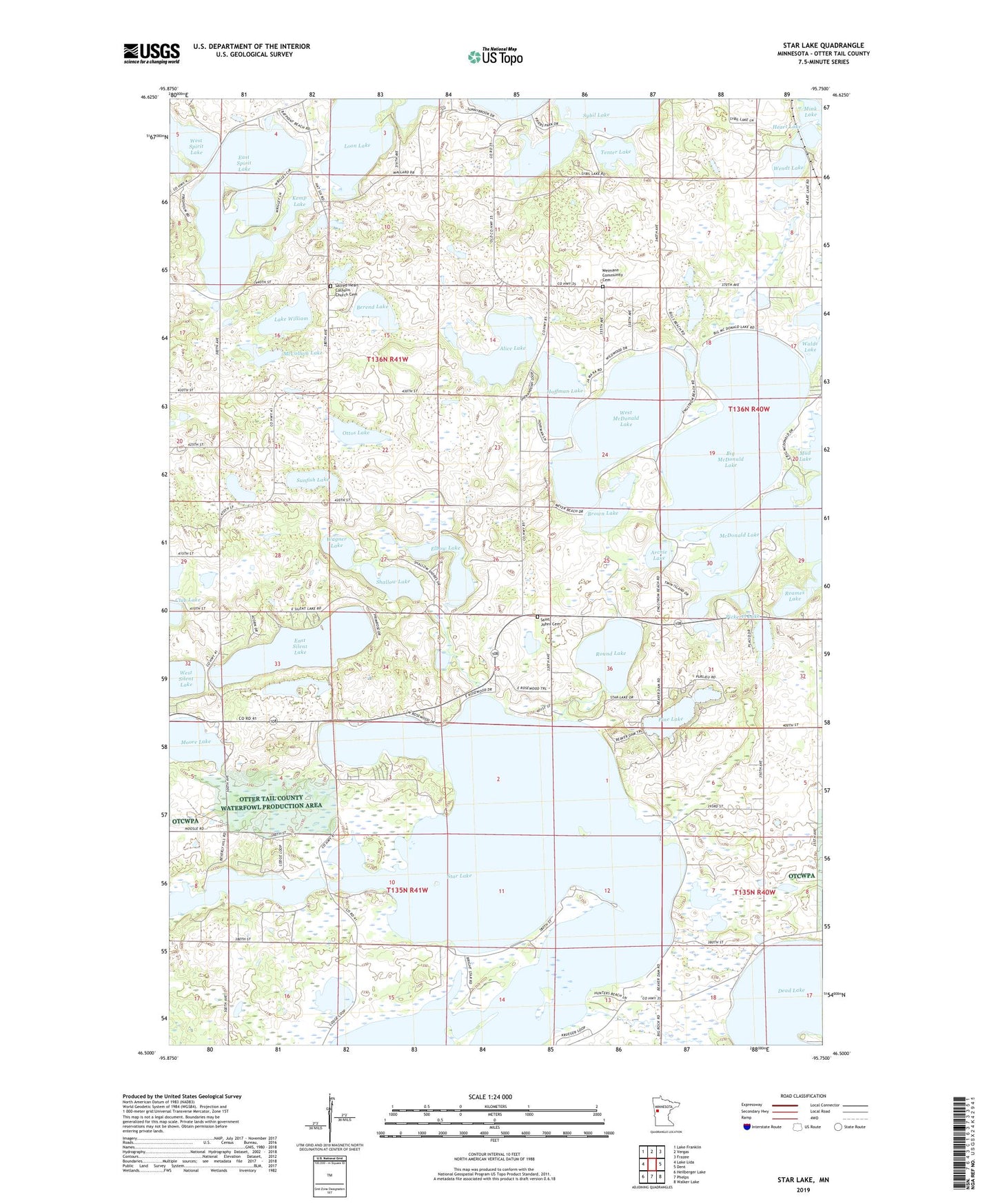
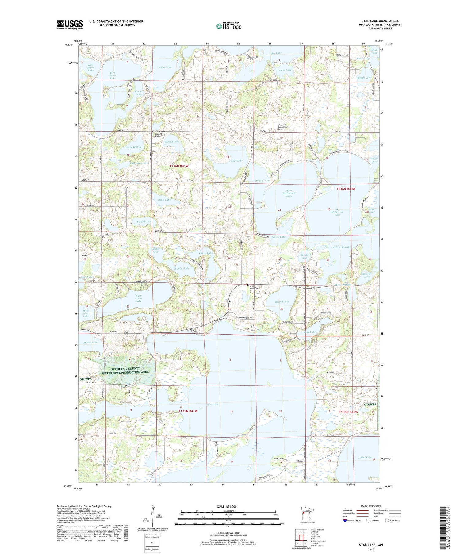
2019 topographic map quadrangle Star Lake in the state of Minnesota. Scale: 1:24000. Based on the newly updated USGS 7.5' US Topo map series, this map is in the following counties: Otter Tail. The map contains contour data, water features, and other items you are used to seeing on USGS maps, but also has updated roads and other features. This is the next generation of topographic maps. Printed on high-quality waterproof paper with UV fade-resistant inks.
Quads adjacent to this one:
West: Lake Lida
Northwest: Lake Franklin
North: Vergas
Northeast: Frazee
East: Dent
Southeast: Walker Lake
South: Phelps
Southwest: Heilberger Lake
Contains the following named places: Alice Lake, Archie Lake, Berend Lake, Big McDonald Lake, Brown Lake, Club Lake, Dora Post Offie, Dry Sand Lake, Dry Sand Lake Wildlife Management Unit Dam, East Silent Lake, East Spirit Lake, Elbow Lake, Frank's Lodge and Campground, Heart Lake, Hoffman Lake, Kemp Lake, Krueger Loon Lake Seaplane Base, Lake William, McCollum Lake, McDonald Lake, McDonald Lakes Dam, Moore Lake, Ottos Lake, Pickerel Lake, Pine Lake, Pleasant Lake, Reames Lake, Redington Post Office, Round Lake, Round Lake Rest Area, Sacred Heart Catholic Church Cemetery, Saint Johns Cemetery, Saint John's Lutheran Church, Seclusion Point Campground, Shallow Lake, Spirit Lake Post Office, Star Lake, Sunfish Lake, Tenter Lake, Township of Dora, Wagner Lake, Weimann Community Cemetery, Wendt Lake, West McDonald Lake, ZIP Code: 56528