MyTopo
Stewartville Minnesota US Topo Map
Couldn't load pickup availability
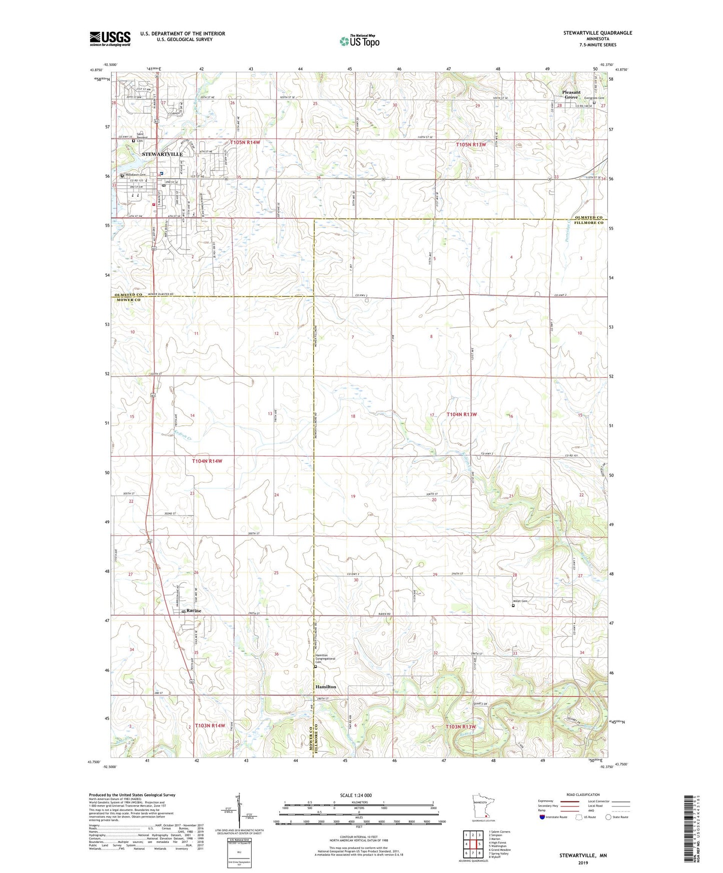
2019 topographic map quadrangle Stewartville in the state of Minnesota. Scale: 1:24000. Based on the newly updated USGS 7.5' US Topo map series, this map is in the following counties: Fillmore, Mower, Olmsted. The map contains contour data, water features, and other items you are used to seeing on USGS maps, but also has updated roads and other features. This is the next generation of topographic maps. Printed on high-quality waterproof paper with UV fade-resistant inks.
Quads adjacent to this one:
West: High Forest
Northwest: Salem Corners
North: Simpson
Northeast: Marion
East: Washington
Southeast: Wykoff
South: Spring Valley
Southwest: Grand Meadow
Contains the following named places: Bear Creek Dam, Bear Creek Reservoir, Beverly Healthcare Center, Bonner Elementary School, Carey Creek, Central Intermediate School, City of Racine, City of Stewartville, Evergreen Cemetery, First Baptist Church, First Congregational Church, Grace Evangelical Free Church, Hamilton, Hamilton Congregational Cemetery, Hamilton Post Office, Lake Florence, Millet Cemetery, Olmsted Medical Center, Pleasant Grove, Pleasant Grove Church of Christ, Pleasantgrove Post Office, Racine, Racine Post Office, Racine Village Hall, Rochester Medical Corporation Center, Saint Bernard Cemetery, Saint Bernard's Catholic Church, Saint John's Lutheran Church, Southern Hills Mobile Home Park, Stewartville, Stewartville Assembly of God Church, Stewartville Care Center, Stewartville Christian Church, Stewartville Dam, Stewartville Fire Department, Stewartville Junior - Senior High School, Stewartville Post Office, Stewartville Public Library, Stewartville United Methodist Church, Sumner Center Church, Township of Sumner, United Methodist Church, Willow Green Country Club, Woodlawn Cemetery, Zion Lutheran Church, ZIP Code: 55976