MyTopo
Grand Meadow Minnesota US Topo Map
Couldn't load pickup availability
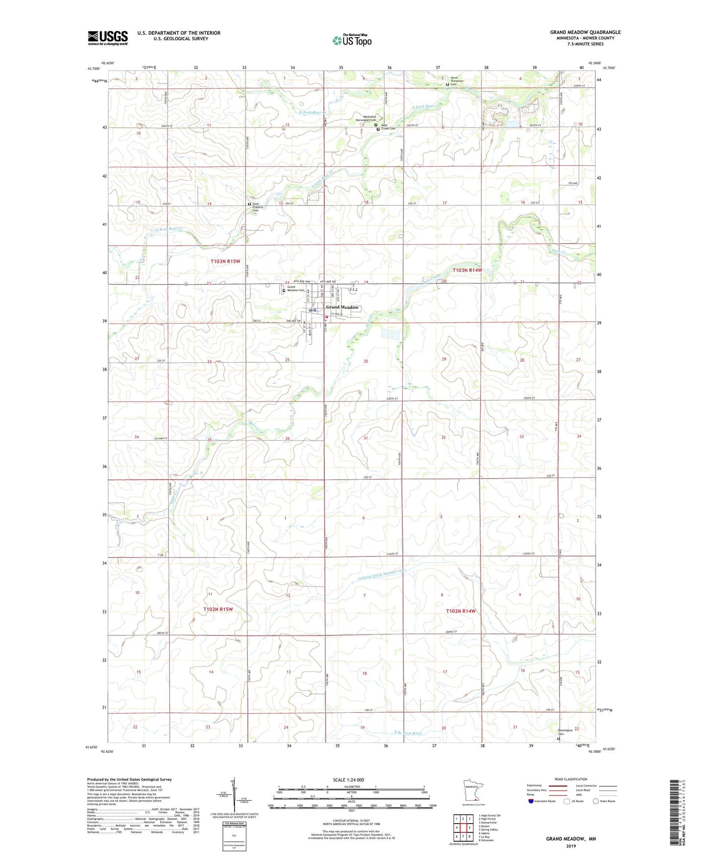
2022 topographic map quadrangle Grand Meadow in the state of Minnesota. Scale: 1:24000. Based on the newly updated USGS 7.5' US Topo map series, this map is in the following counties: Mower. The map contains contour data, water features, and other items you are used to seeing on USGS maps, but also has updated roads and other features. This is the next generation of topographic maps. Printed on high-quality waterproof paper with UV fade-resistant inks.
Quads adjacent to this one:
West: Dexter
Northwest: High Forest SW
North: High Forest
Northeast: Stewartville
East: Spring Valley
Southeast: Ostrander
South: Le Roy
Southwest: Adams
This map covers the same area as the classic USGS quad with code o43092f5.
Contains the following named places: Bear Creek Cemetery, Bear Creek Church, Bennington Cemetery, City of Grand Meadow, Grand Meadow, Grand Meadow Airport, Grand Meadow Cemetery, Grand Meadow City Hall, Grand Meadow Fire and Rescue, Grand Meadow Health Care Center, Grand Meadow Medical Clinic, Grand Meadow Police Department, Grand Meadow Post Office, Grand Meadow Public Library, Grand Meadow School, Judicial Ditch Number One, Lutheran Church, Meadow Mobile Home Park, Methodist Norwegian Cemetery, North Fork Bear Creek, Pine Lawn Park, Pine Lawn Park Structure Dam, Saint Finbarr's Catholic Church, Saint Finbarrs Cemetery, Sevar Temanson Cemetery, South Fork Bear Creek, Township of Bennington, Township of Frankford, United Church of Grand Meadow, ZIP Code: 55936