MyTopo
Spring Valley Minnesota US Topo Map
Couldn't load pickup availability
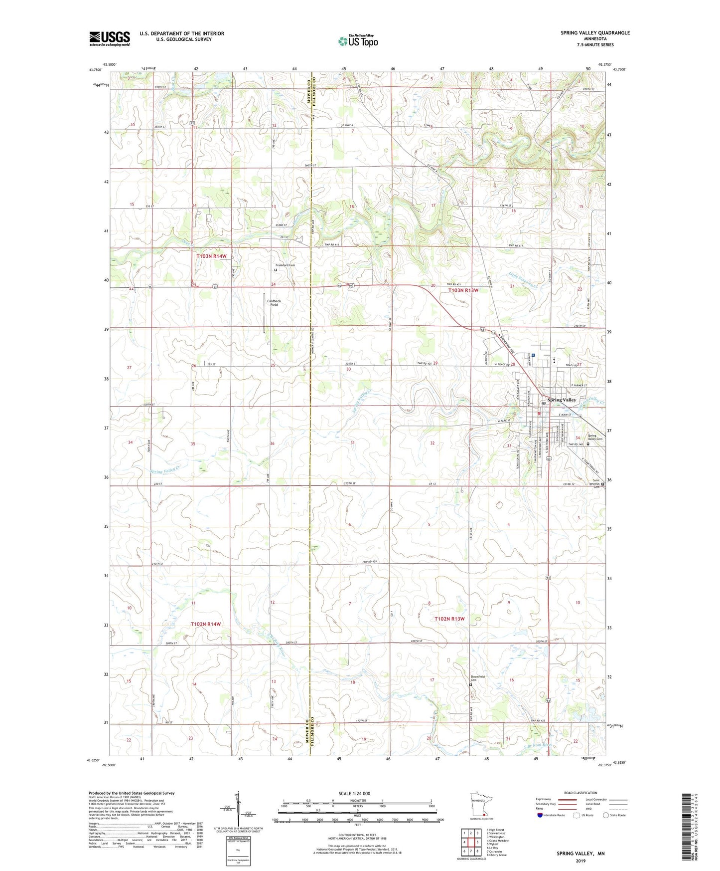
2022 topographic map quadrangle Spring Valley in the state of Minnesota. Scale: 1:24000. Based on the newly updated USGS 7.5' US Topo map series, this map is in the following counties: Fillmore, Mower. The map contains contour data, water features, and other items you are used to seeing on USGS maps, but also has updated roads and other features. This is the next generation of topographic maps. Printed on high-quality waterproof paper with UV fade-resistant inks.
Quads adjacent to this one:
West: Grand Meadow
Northwest: High Forest
North: Stewartville
Northeast: Washington
East: Wykoff
Southeast: Cherry Grove
South: Ostrander
Southwest: Le Roy
This map covers the same area as the classic USGS quad with code o43092f4.
Contains the following named places: Assembly of God Church, Bloomfield Cemetery, Caldbeck Field, City of Spring Valley, Community Memorial Hospital, Deer Creek Campground, Deer Creek Speedway, Faith United Methodist Church, First Baptist Church, First English Lutheran Church, Frankford Cemetery, Grant Street Park, Kingdom Hall of Jehovahs Witnesses, Kingsland Elementary School, Kingsland High School, Matson Field Airport, Methodist Church Museum, North Tower Park, Olmsted Medical Center, Our Saviour's Lutheran Church, Pleasant Valley Mobile Home Park, Saint Ignatius Catholic Church, Saint Ignatius Cemetery, Shady Acre Mobile Home Park, South Park, Spring Valley, Spring Valley Area Ambulance, Spring Valley Care Center, Spring Valley Cemetery, Spring Valley Fire Department, Spring Valley Post Office, Spring Valley Public Library, Spring Valley Trailer Park, Township of Bloomfield, Township of Spring Valley, Washburn-Zittleman Museum