MyTopo
Stingy Lake Minnesota US Topo Map
Couldn't load pickup availability
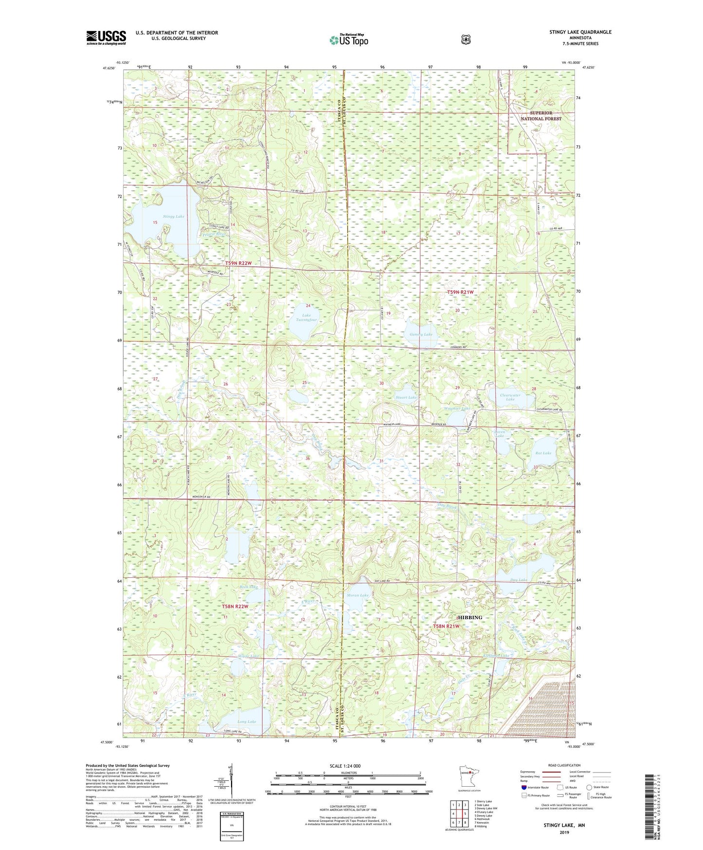
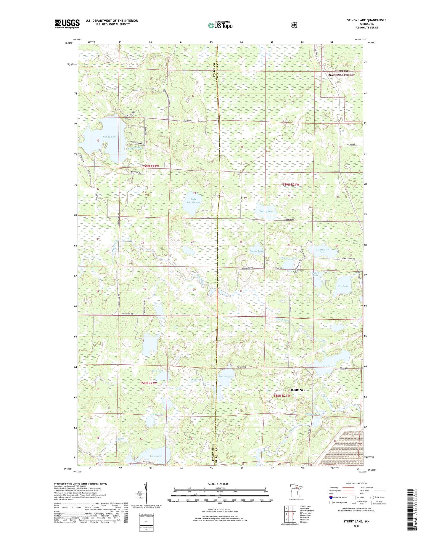
2019 topographic map quadrangle Stingy Lake in the state of Minnesota. Scale: 1:24000. Based on the newly updated USGS 7.5' US Topo map series, this map is in the following counties: St. Louis, Itasca. The map contains contour data, water features, and other items you are used to seeing on USGS maps, but also has updated roads and other features. This is the next generation of topographic maps. Printed on high-quality waterproof paper with UV fade-resistant inks.
Quads adjacent to this one:
Northwest: Sherry Lake
North: Side Lake
Northeast: Dewey Lake NW
East: Dewey Lake
Southeast: Hibbing
South: Keewatin
Southwest: Nashwauk
Contains the following named places: Clearwater Lake, Day Lake, Deer Creek, Gansey Lake, Hibbing Taconite Starter Dam One, Hibbing Taconite Starter Dam Two, Kleffman Lake, Lake Twentyfour, Long Lake, Loven Lake, Moose Lake, Moran Lake, Rat Lake, Rock Creek, Rock Lake, Rock Lake Creek, Stingy Lake, Stuart Lake, Waymier Lake