MyTopo
Strawberry Lake Minnesota US Topo Map
Couldn't load pickup availability
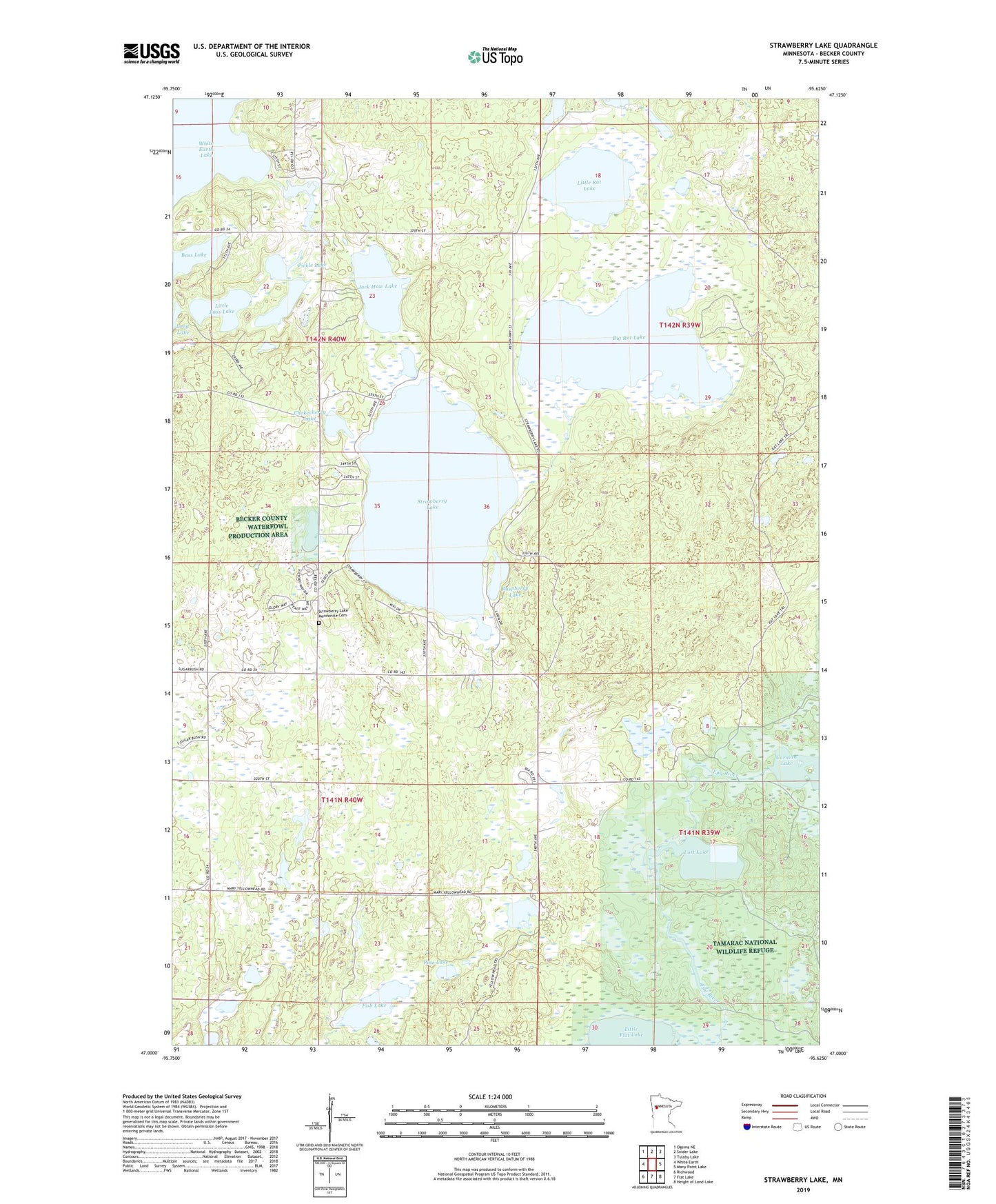
2019 topographic map quadrangle Strawberry Lake in the state of Minnesota. Scale: 1:24000. Based on the newly updated USGS 7.5' US Topo map series, this map is in the following counties: Becker. The map contains contour data, water features, and other items you are used to seeing on USGS maps, but also has updated roads and other features. This is the next generation of topographic maps. Printed on high-quality waterproof paper with UV fade-resistant inks.
Quads adjacent to this one:
West: White Earth
Northwest: Ogema NE
North: Snider Lake
Northeast: Tulaby Lake
East: Many Point Lake
Southeast: Height of Land Lake
South: Flat Lake
Southwest: Richwood
Contains the following named places: Bass Lake, Big Rat Lake, Black Earth Lake, Carman Lake, Chokecherry Lake, Egg Lake Lookout Tower, Fish Lake, Jack Haw Lake, Little Bass Lake, Little Flat Lake, Little Rat Lake, Lost Lake, Mary Yellowhead Lake, Ogemash Dam, Ogemash Reservoir, Pickle Lake, Pine Lake, Raspberry Lake, Strawberry Lake, Strawberry Lake Church, Strawberry Lake Mennonite Cemetery, Strawberry Lake School, Township of Maple Grove, Township of Sugar Bush