MyTopo
Ogema NE Minnesota US Topo Map
Couldn't load pickup availability
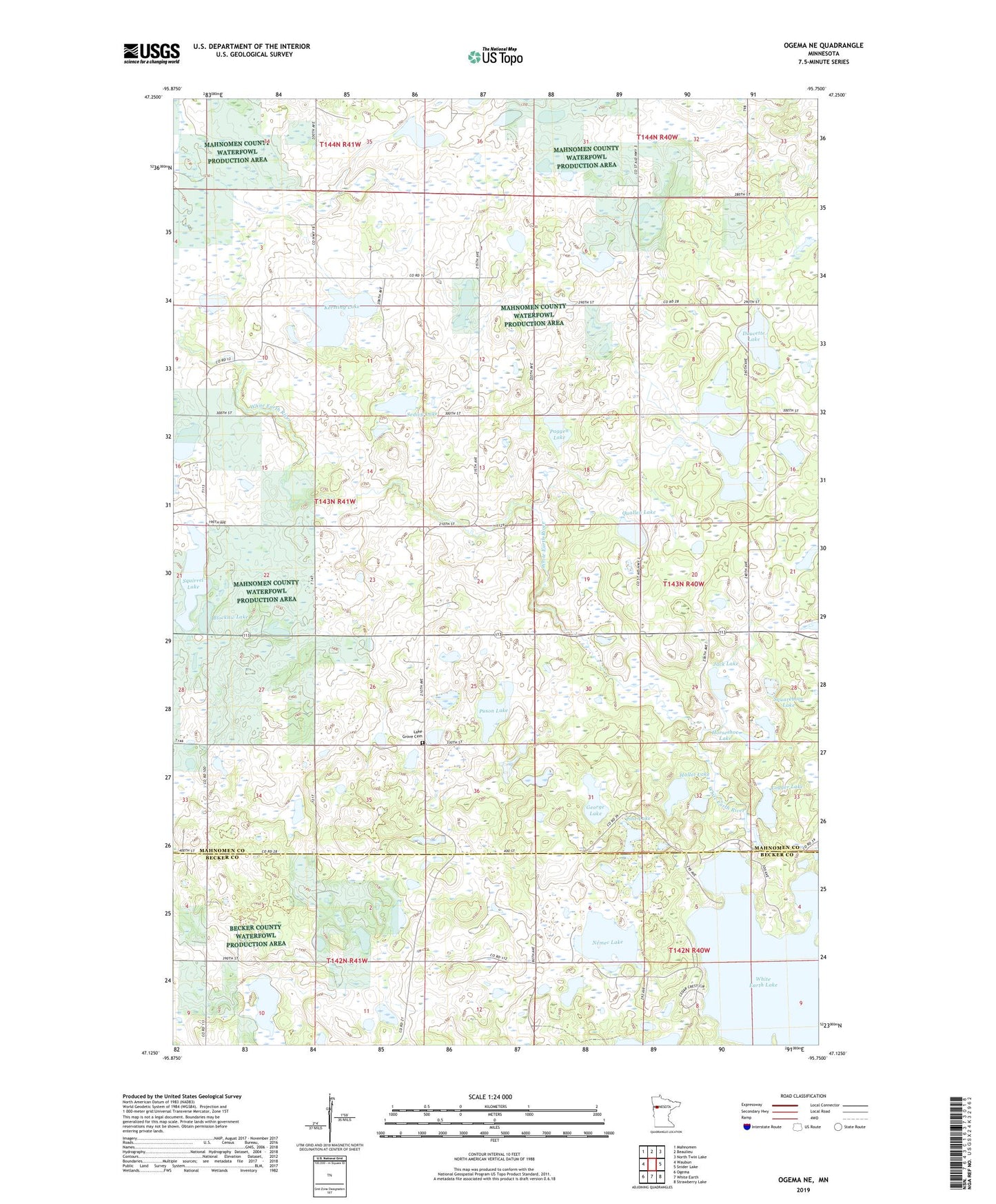
2022 topographic map quadrangle Ogema NE in the state of Minnesota. Scale: 1:24000. Based on the newly updated USGS 7.5' US Topo map series, this map is in the following counties: Mahnomen, Becker. The map contains contour data, water features, and other items you are used to seeing on USGS maps, but also has updated roads and other features. This is the next generation of topographic maps. Printed on high-quality waterproof paper with UV fade-resistant inks.
Quads adjacent to this one:
West: Waubun
Northwest: Mahnomen
North: Beaulieu
Northeast: North Twin Lake
East: Snider Lake
Southeast: Strawberry Lake
South: White Earth
Southwest: Ogema
This map covers the same area as the classic USGS quad with code o47095b7.
Contains the following named places: Blocknic Lake, Burns Eighty Lake, Doucette Lake, Du Forte Lake, Espe Lake, George Lake, Hallot Lake, Horseshoe Lake, Jack Lake, Kersting Lake, Lake Grove Cemetery, Lake Grove Church, Logger Lake, Nemec Lake, Ox-Bow Resort and Campground, Paggen Lake, Pine Lake, Poodle Park, Port of Cedar Crest Campground, Puson Lake, Quallen Lake, Sedivy Lake, Squareboat Lake, Squirrel Lake, Township of Lake Grove, White Earth Lake, White Earth Lake Dam