MyTopo
Twin Valley Minnesota US Topo Map
Couldn't load pickup availability
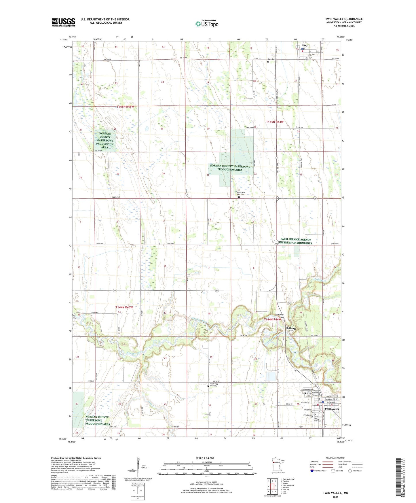
2022 topographic map quadrangle Twin Valley in the state of Minnesota. Scale: 1:24000. Based on the newly updated USGS 7.5' US Topo map series, this map is in the following counties: Norman. The map contains contour data, water features, and other items you are used to seeing on USGS maps, but also has updated roads and other features. This is the next generation of topographic maps. Printed on high-quality waterproof paper with UV fade-resistant inks.
Quads adjacent to this one:
West: Twin Valley SW
Northwest: Twin Valley NW
North: Flaming
Northeast: Ranum
East: Waukon
Southeast: Flom
South: Syre
Southwest: Ulen NW
This map covers the same area as the classic USGS quad with code o47096c3.
Contains the following named places: Altru Clinic - Fertile, City of Gary, City of Twin Valley, Coon Creek, Gary, Gary Cemetery, Gary Lutheran Church, Gary Police Department, Gary Post Office, Gary Public School, Gary Volunteer Fire Department, Good News Fellowship, Heiberg, Heiberg Post Office, Lutheran Memorial Home, Mashaug Creek, Merit Care Clinic Twin Valley, Norman County East Elementary School, Norman County East High School, North Wild Rice Cemetery, Saint Williams Catholic Church, Saint Williams Cemetery, Township of Strand, Township of Wild Rice, Trinity Cemetery, Trinity Lutheran Church, Twin Valley, Twin Valley City Cemetery, Twin Valley Fire Department, Twin Valley Mobile Home Park, Twin Valley Police Department, Twin Valley Post Office, West Wild Rice Cemetery, Wild Rice River Reservoir, Wild Rice River River Dam, Zion Cemetery, Zion Lutheran Church, Zion Memorial Gardens