
MyTopo
Wadena Minnesota US Topo Map
Couldn't load pickup availability
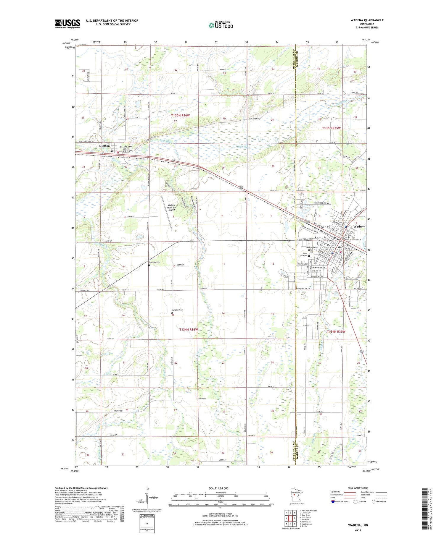
2019 topographic map quadrangle Wadena in the state of Minnesota. Scale: 1:24000. Based on the newly updated USGS 7.5' US Topo map series, this map is in the following counties: Otter Tail, Wadena. The map contains contour data, water features, and other items you are used to seeing on USGS maps, but also has updated roads and other features. This is the next generation of topographic maps. Printed on high-quality waterproof paper with UV fade-resistant inks.
Quads adjacent to this one:
West: Deer Creek
Northwest: New York Mills East
North: Sebeka SW
Northeast: Blue Grass
East: Verndale
Southeast: Bertha
South: Wrightstown
Southwest: Henning SE
Contains the following named places: Alliance Church, Bluff Creek, Bluffton, Bluffton Fire Department, Bluffton Post Office, City of Bluffton, City of Wadena, Compton Cemetery, Compton Church, Gustafva Cemetery, Oak Creek, Saint Ann' Cemetery, Saint Anns School, Saint John's Catholic Church, Saint John's Catholic Church Cemetery, Sonrise Christian School, Southbrook Church, Township of Compton, Tri - County Health Care Hospital, Tri-County Heliport, Wadena, Wadena Cemetery, Wadena County Jail, Wadena County Sheriff's Office, Wadena Fire Department, Wadena Municipal Airport, Wadena Police Department, Wadena Post Office, West Wind Estates, ZIP Code: 56482


