
MyTopo
Wahpeton NE Minnesota US Topo Map
Couldn't load pickup availability
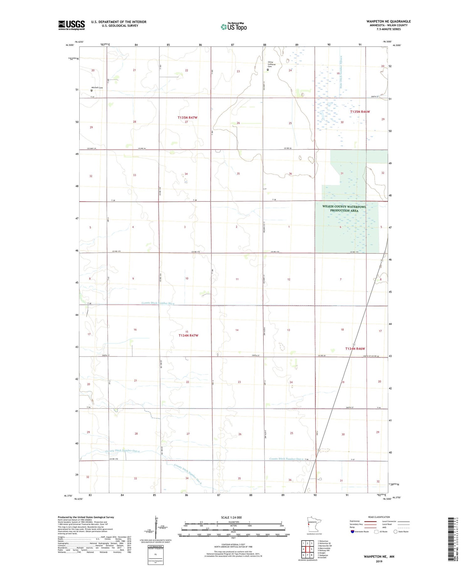
2019 topographic map quadrangle Wahpeton NE in the state of Minnesota. Scale: 1:24000. Based on the newly updated USGS 7.5' US Topo map series, this map is in the following counties: Wilkin. The map contains contour data, water features, and other items you are used to seeing on USGS maps, but also has updated roads and other features. This is the next generation of topographic maps. Printed on high-quality waterproof paper with UV fade-resistant inks.
Quads adjacent to this one:
West: Abercrombie
Northwest: Wolverton
North: Wolverton SE
Northeast: Barnesville SW
East: Rothsay NW
Southeast: Everdell
South: Wahpeton
Southwest: Dwight
Contains the following named places: Christ Church, Christ Lutheran Cemetery, County Ditch Number One-a, County Ditch Number One-b, County Ditch Number Six-a, County Ditch Number Twentythree, Manston State Wildlife Management Area, Mitchell Cemetery, State Ditch Number Fifteen, Township of Nordick, Wilkin County Waterfowl Production Area, ZIP Code: 56553


