MyTopo
Dwight North Dakota US Topo Map
Couldn't load pickup availability
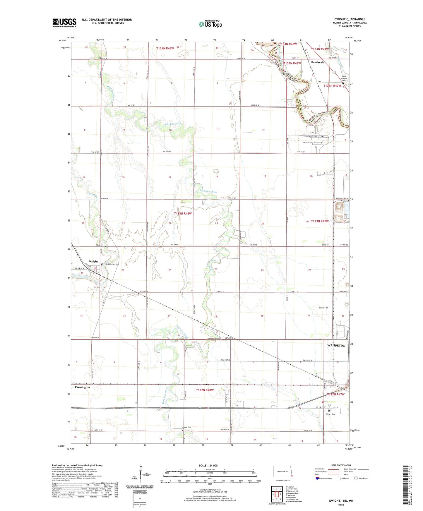
2024 topographic map quadrangle Dwight in the states of North Dakota, Minnesota. Scale: 1:24000. Based on the newly updated USGS 7.5' US Topo map series, this map is in the following counties: Richland, Wilkin. The map contains contour data, water features, and other items you are used to seeing on USGS maps, but also has updated roads and other features. This is the next generation of topographic maps. Printed on high-quality waterproof paper with UV fade-resistant inks.
Quads adjacent to this one:
West: Mooreton East
Northwest: Galchutt
North: Abercrombie
Northeast: Wahpeton NE
East: Wahpeton
Southeast: South of Wahpeton
South: Fairmount NW
Southwest: Great Bend
This map covers the same area as the classic USGS quad with code o46096c6.
Contains the following named places: Brushvale, Brushvale Post Office, Brushvale School, Calvary Cemetery, Carmelite Monastery, Center Town Hall, City of Dwight, Dwight, Dwight Fire Protection District, Dwight Fire Protection District 2, Dwight Township Hall, Faith Lutheran Cemetery, Hanson Dam, Kongsberg, Moore Cemetery, Saint Josephs Cemetery, School Number 2, Township of Dwight, ZIP Code: 58075