MyTopo
Washington Minnesota US Topo Map
Couldn't load pickup availability
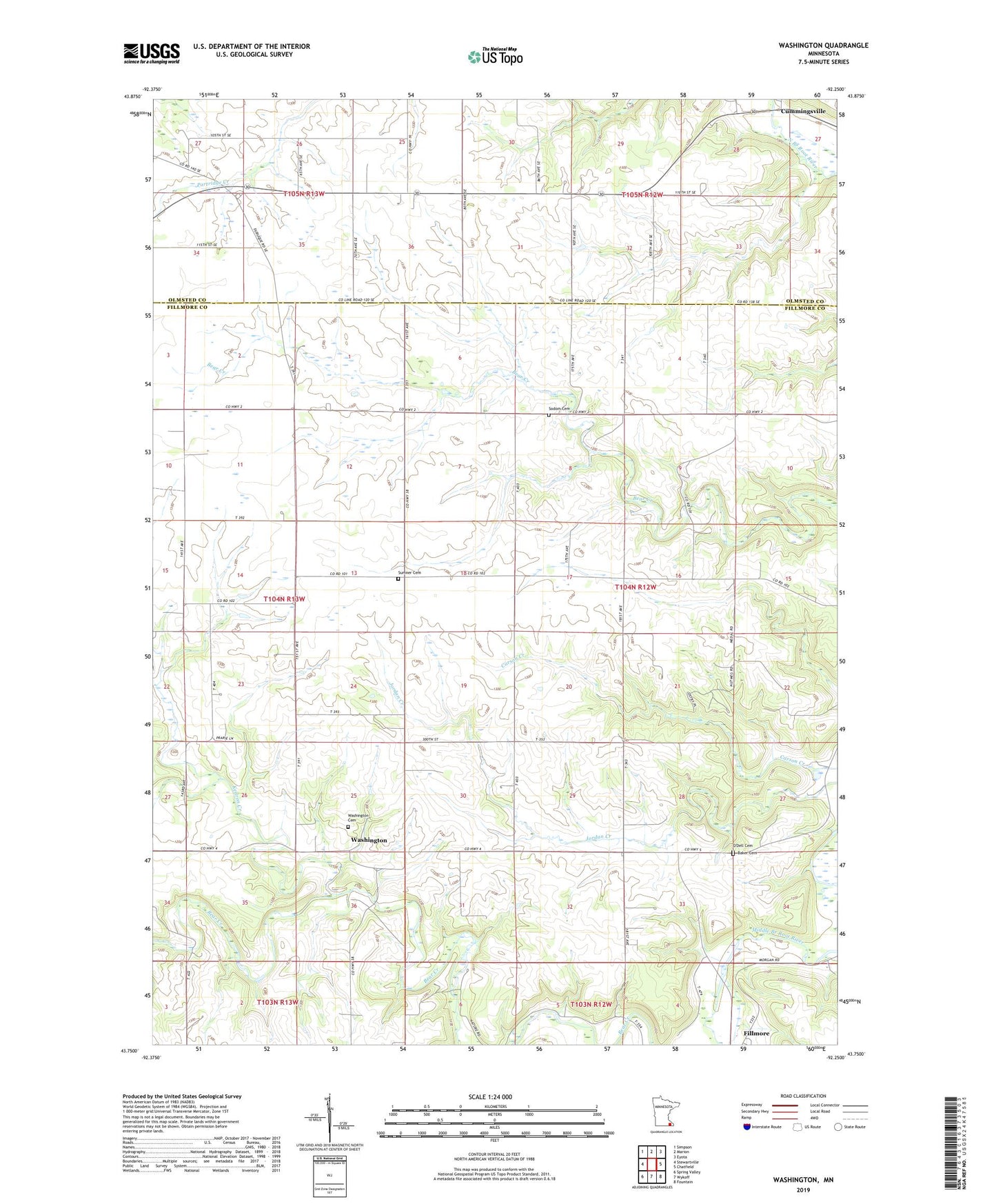
2019 topographic map quadrangle Washington in the state of Minnesota. Scale: 1:24000. Based on the newly updated USGS 7.5' US Topo map series, this map is in the following counties: Fillmore, Olmsted. The map contains contour data, water features, and other items you are used to seeing on USGS maps, but also has updated roads and other features. This is the next generation of topographic maps. Printed on high-quality waterproof paper with UV fade-resistant inks.
Quads adjacent to this one:
West: Stewartville
Northwest: Simpson
North: Marion
Northeast: Eyota
East: Chatfield
Southeast: Fountain
South: Wykoff
Southwest: Spring Valley
Contains the following named places: Baker Cemetery, Cummingsville, Flying A Airport, Kedron Creek, Ness Rudlong and Ellenberg Group Dam, O'Dell Cemetery, Rudlong Structure Dam, Sodom Cemetery, Sumner Cemetery, Township of Jordan, Washington, Washington Cemetery, Washington Post Office