MyTopo
Fountain Minnesota US Topo Map
Couldn't load pickup availability
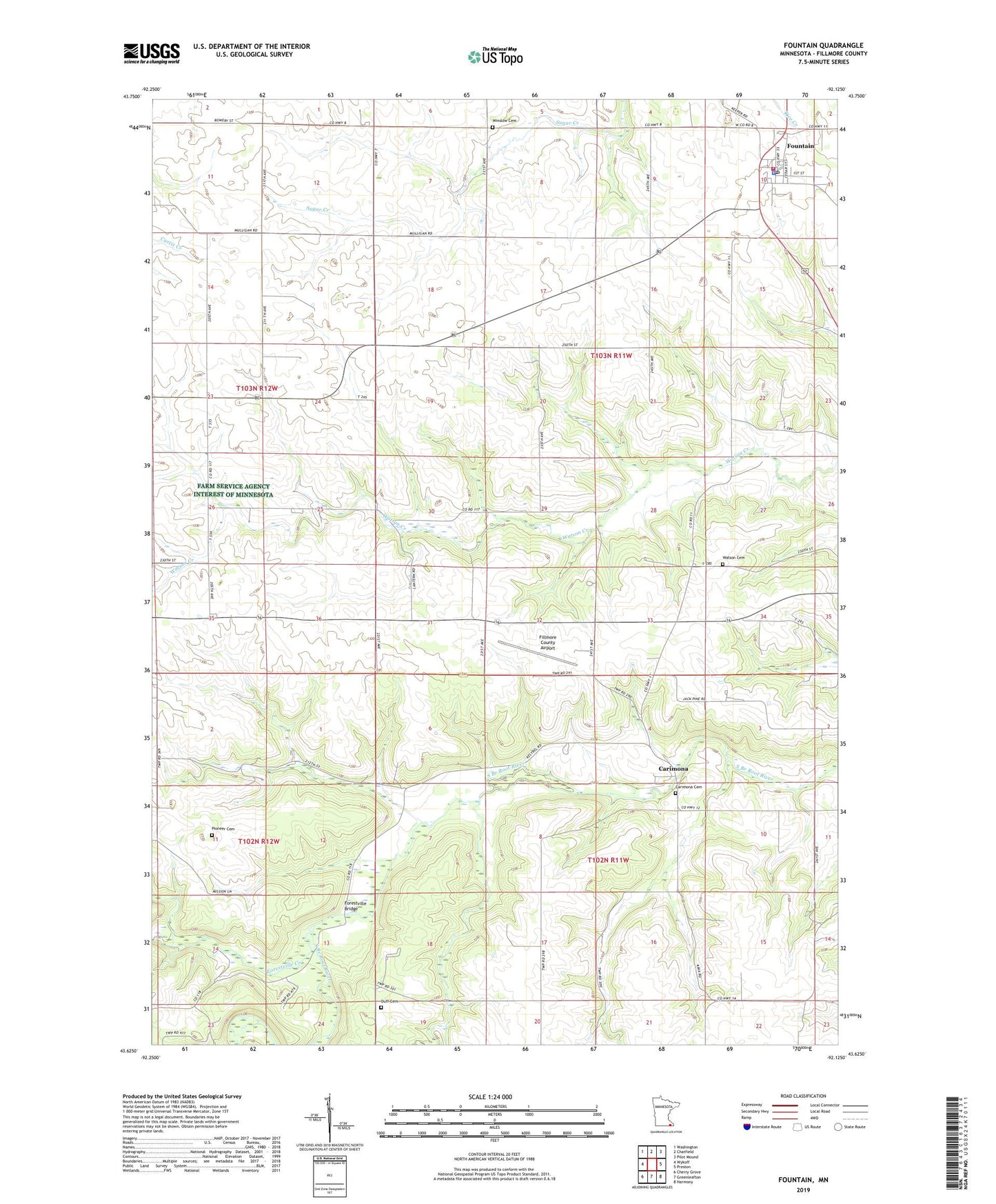
2022 topographic map quadrangle Fountain in the state of Minnesota. Scale: 1:24000. Based on the newly updated USGS 7.5' US Topo map series, this map is in the following counties: Fillmore. The map contains contour data, water features, and other items you are used to seeing on USGS maps, but also has updated roads and other features. This is the next generation of topographic maps. Printed on high-quality waterproof paper with UV fade-resistant inks.
Quads adjacent to this one:
West: Wykoff
Northwest: Washington
North: Chatfield
Northeast: Pilot Mound
East: Preston
Southeast: Harmony
South: Greenleafton
Southwest: Cherry Grove
This map covers the same area as the classic USGS quad with code o43092f2.
Contains the following named places: Carimona, Carimona Cemetery, Carimona Post Office, City of Fountain, Duff Cemetery, Eickhoff Detention Dam, Erickson Detention Dam, Fillmore County Airport, Fillmore County Historical Center, Forestville, Forestville Bridge, Forestville Creek, Forestville Post Office, Forestville State Park, Fountain, Fountain Fire Department, Fountain Lutheran Church, Fountain Methodist Church, Fountain Police Department, Fountain Post Office, Geology of Sinkholes Historical Marker, KFIL-AM (Preston), KFIL-FM (Preston), Otto Meyer Dam, Pioneer Cemetery, Township of Carimona, Township of Fillmore, Township of Fountain, Watson Cemetery, Winslow Cemetery