MyTopo
Watertown Minnesota US Topo Map
Couldn't load pickup availability
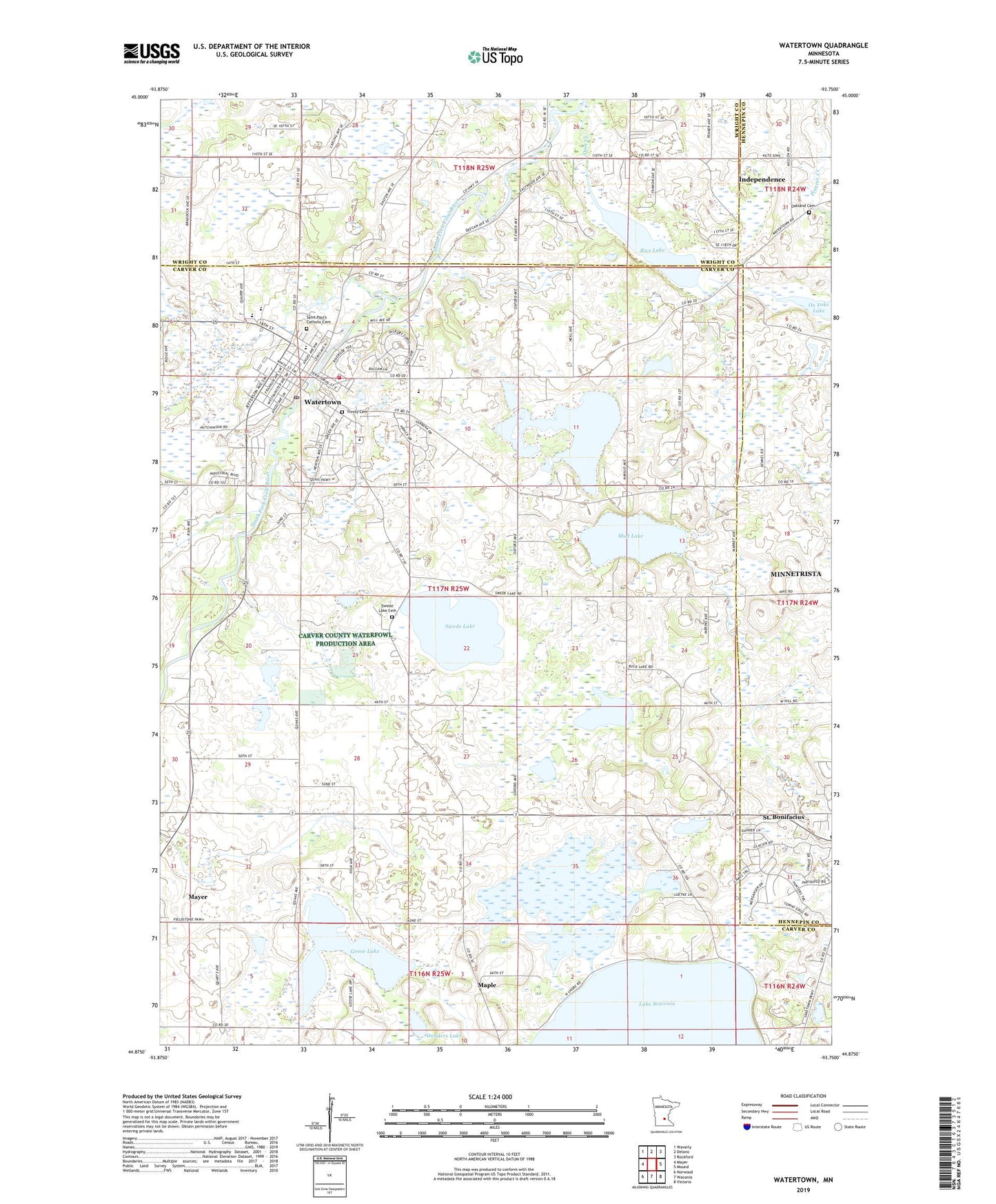
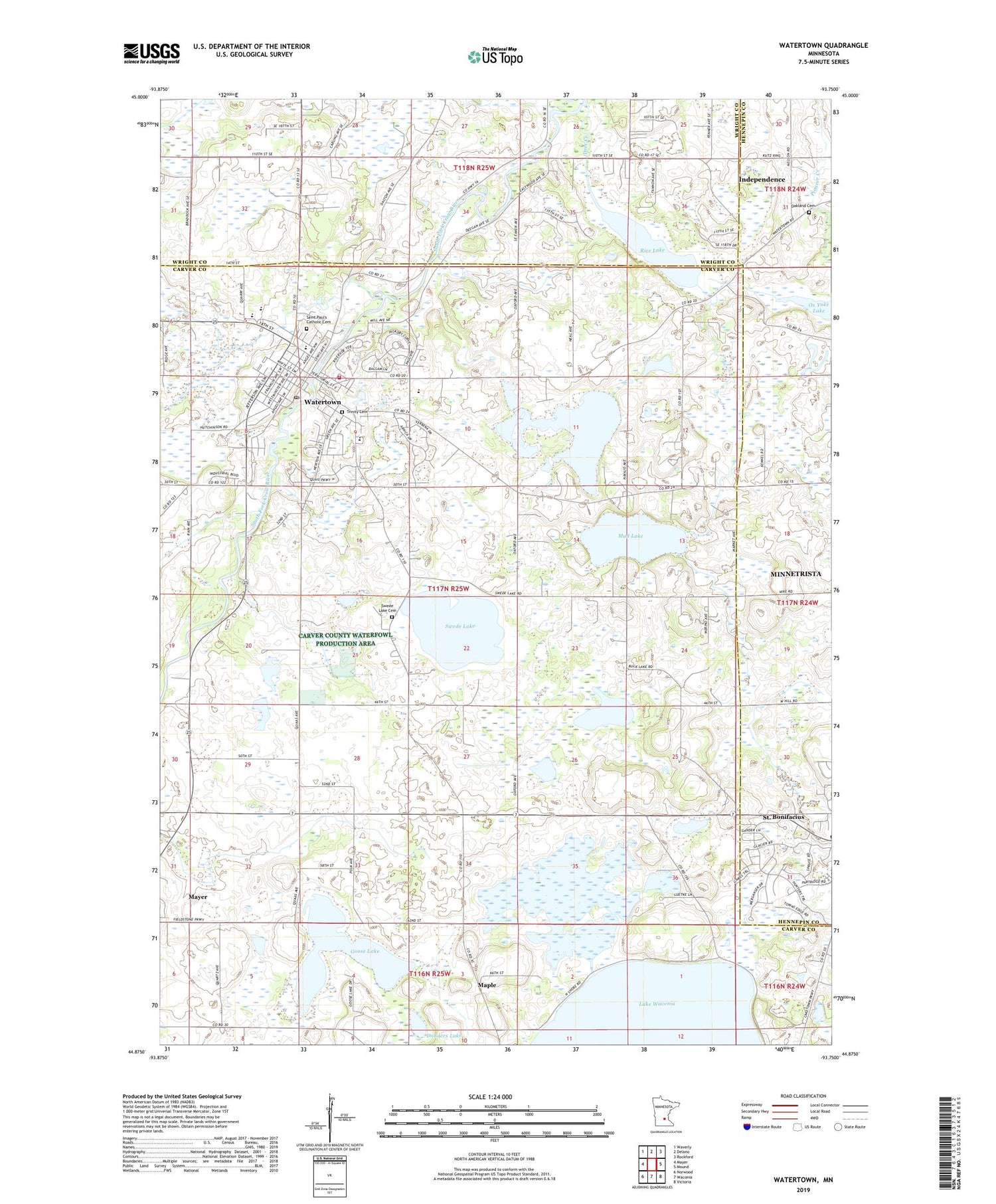
2019 topographic map quadrangle Watertown in the state of Minnesota. Scale: 1:24000. Based on the newly updated USGS 7.5' US Topo map series, this map is in the following counties: Carver, Wright, Hennepin. The map contains contour data, water features, and other items you are used to seeing on USGS maps, but also has updated roads and other features. This is the next generation of topographic maps. Printed on high-quality waterproof paper with UV fade-resistant inks.
Quads adjacent to this one:
West: Mayer
Northwest: Waverly
North: Delano
Northeast: Rockford
East: Mound
Southeast: Victoria
South: Waconia
Southwest: Norwood
Contains the following named places: Ames Farm, Boll Farm, Buck Lake, Christ Community Lutheran School, City of Watertown, Deer Creek, Donders Lake, Elim Nursing Home, Evangelical Free Church, Goose Lake, Hanlin School, Immaculate Conception Parish, KWOM-AM (Watertown), Maple, Mud Lake, Oak Lake, Oak Lake School, Oakland Cemetery, Rice Lake, Rivers Edge Country Club, Riverside Terrace Mobile Home Park, Saint Paul's Catholic Cemetery, Saint Paul's Lutheran Church, Saint Peter Lutheran Church, Saint Peters Church, Saint Peters School, Schaunamann School, Swede Lake, Swede Lake Cemetery, Swede Lake School, Timber Creek Golf Course, Township of Watertown, Trinity Cemetery, Trinity Lutheran Church, Waconia State Wildlife Management Area, Watertown, Watertown - Mayer Elementary School, Watertown - Mayer High School, Watertown - Mayer Middle School, Watertown - Mayer Primary School, Watertown Fire Department, Watertown Library, Watertown Post Office, Welker School, White Mobile Home Park, Yaney School, ZIP Code: 55388